IMAGES TAKEN NEAR TO
Tilecotes Close, MARLOW, SL7 2NU
Introduction
This page details the photographs taken nearby to Tilecotes Close, SL7 2NU by members of the Geograph project.
The Geograph project started in 2005 with the aim of publishing, organising and preserving representative images for every square kilometre of Great Britain, Ireland and the Isle of Man.

There are currently over 7.5m images from over14,400 individuals and you can help contribute to the project by visiting https://www.geograph.org.uk
Image Map
Images are licensed for reuse under creativecommons.org/licenses/by-sa/2.0
Notes
- Clicking on the map will re-center to the selected point.
- The higher the marker number, the further away the image location is from the centre of the postcode.
Image Listing (146 Images Found)
Images are licensed for reuse under creativecommons.org/licenses/by-sa/2.0
Image
Details
Distance


5

Marlow - Chiltern Road
Short dead end road off Chalkpit Lane.
Image: © James Emmans
Taken: 29 Jul 2020
0.16 miles
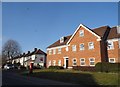
6
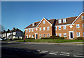
Bank Apartments, Dean Street, Marlow
Image: © Des Blenkinsopp
Taken: 20 Apr 2013
0.17 miles
7
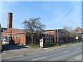
Marlow Telephone Exchange, Bucks
Situated in Dean Street, this TE replaced the former Manual TE in about 1960. In addition to Marlow, it also serves Bisham, Cookham Dean, Little Marlow and Marlow Bottom nearby. Its postcode is SL7 3AA.
Image: © David Hillas
Taken: 13 Apr 2010
0.17 miles
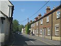
10
Side of house on Chalkpit Lane, Marlow
Image: © David Howard
Taken: 12 Jul 2015
0.18 miles