IMAGES TAKEN NEAR TO
Rookery Gardens, MARLOW, SL7 1BD
Introduction
This page details the photographs taken nearby to Rookery Gardens, SL7 1BD by members of the Geograph project.
The Geograph project started in 2005 with the aim of publishing, organising and preserving representative images for every square kilometre of Great Britain, Ireland and the Isle of Man.

There are currently over 7.5m images from over14,400 individuals and you can help contribute to the project by visiting https://www.geograph.org.uk
Image Map
Images are licensed for reuse under creativecommons.org/licenses/by-sa/2.0
Notes
- Clicking on the map will re-center to the selected point.
- The higher the marker number, the further away the image location is from the centre of the postcode.
Image Listing (179 Images Found)
Images are licensed for reuse under creativecommons.org/licenses/by-sa/2.0
Image
Details
Distance

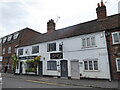
5
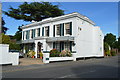
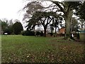
Cedar House
Grade II listed. https://britishlistedbuildings.co.uk/101125102-cedar-house-marlow
Image: © N Chadwick
Taken: 24 Jun 2018
0.07 miles
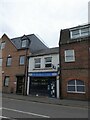
6
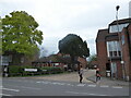
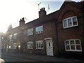
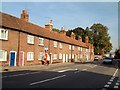
Looking from Chapel Street into Liston Road
Image: © Basher Eyre
Taken: 5 Sep 2020
0.07 miles