IMAGES TAKEN NEAR TO
Lillibrooke Crescent, MAIDENHEAD, SL6 3XQ
Introduction
This page details the photographs taken nearby to Lillibrooke Crescent, SL6 3XQ by members of the Geograph project.
The Geograph project started in 2005 with the aim of publishing, organising and preserving representative images for every square kilometre of Great Britain, Ireland and the Isle of Man.

There are currently over 7.5m images from over14,400 individuals and you can help contribute to the project by visiting https://www.geograph.org.uk
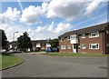
Image Map
Images are licensed for reuse under creativecommons.org/licenses/by-sa/2.0
Notes
- Clicking on the map will re-center to the selected point.
- The higher the marker number, the further away the image location is from the centre of the postcode.
Image Listing (6 Images Found)
Images are licensed for reuse under creativecommons.org/licenses/by-sa/2.0
Image
Details
Distance
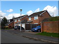
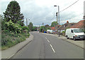
2
White Paddock. Woodlands Park
Houses on the eastern side of the square formed by the roads at the centre of the estate.
Image: © Andrew Smith
Taken: 28 Jun 2008
0.21 miles
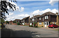
4
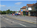
Waltham Road, Woodlands Park
On the approach to the junction with Cannon Lane. The row of shops includes a carpet retailer, Chinese takeaway, convenience store, pharmacy, newsagent and a firm of architects.
Image: © Andrew Smith
Taken: 28 Jun 2008
0.24 miles