IMAGES TAKEN NEAR TO
Broadmoor Road, MAIDENHEAD, SL6 3TB
Introduction
This page details the photographs taken nearby to Broadmoor Road, SL6 3TB by members of the Geograph project.
The Geograph project started in 2005 with the aim of publishing, organising and preserving representative images for every square kilometre of Great Britain, Ireland and the Isle of Man.

There are currently over 7.5m images from over14,400 individuals and you can help contribute to the project by visiting https://www.geograph.org.uk
Image Map
Images are licensed for reuse under creativecommons.org/licenses/by-sa/2.0
Notes
- Clicking on the map will re-center to the selected point.
- The higher the marker number, the further away the image location is from the centre of the postcode.
Image Listing (31 Images Found)
Images are licensed for reuse under creativecommons.org/licenses/by-sa/2.0
Image
Details
Distance
1
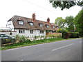
Houses close to Shottesbrooke Park
Looks like the houses were cottages at one point and could have an interesting history.
Image: © James Emmans
Taken: 23 May 2017
0.00 miles
2
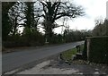
Junction of Broadmoor Road with the drive to Shottesbrooke Park
Image: © Basher Eyre
Taken: 5 Feb 2022
0.07 miles
3
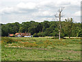
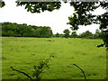
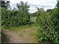
Rough pasture
A large field with the houses on the B3024, Broadmoor Road on the far side.
Image: © Alan Hunt
Taken: 17 Jul 2014
0.09 miles
5
Field next to the B3024 close to Burringham Wood
Image: © James Emmans
Taken: 23 May 2017
0.14 miles
6
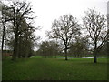
Shottesbrooke Park
Looking north from the public footpath.
Image: © don cload
Taken: 7 Apr 2010
0.16 miles
7
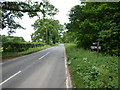
B3024 next to Burringham Wood
Part of the Knowl Hill Bridleway Circuit.
Image: © James Emmans
Taken: 23 May 2017
0.17 miles
8
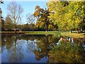
Pond, Shottesbrooke Park
Looking across the northern side of the pond. One of the buildings south of the church is just visible.
Image: © Andrew Smith
Taken: 2 Nov 2007
0.17 miles
9
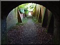
Public footpath, Shottesbrooke
The footpath from Waltham St Lawrence, which, having passed through a short tunnel, six feet high, proceeds between the walled gardens of Shottesbrooke Park. The archway ahead leads into the churchyard.
Image: © Andrew Smith
Taken: 2 Nov 2007
0.18 miles
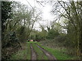
10
Downfield Lane
Downfield Lane, a bridleway that forms part of the Knowl Hill Bridleway Circuit, with a stile into the field south of the B3024.
Image: © Alan Hunt
Taken: 17 Jul 2014
0.18 miles