IMAGES TAKEN NEAR TO
Forest Green Road, MAIDENHEAD, SL6 2NS
Introduction
This page details the photographs taken nearby to Forest Green Road, SL6 2NS by members of the Geograph project.
The Geograph project started in 2005 with the aim of publishing, organising and preserving representative images for every square kilometre of Great Britain, Ireland and the Isle of Man.

There are currently over 7.5m images from over14,400 individuals and you can help contribute to the project by visiting https://www.geograph.org.uk
Image Map
Images are licensed for reuse under creativecommons.org/licenses/by-sa/2.0
Notes
- Clicking on the map will re-center to the selected point.
- The higher the marker number, the further away the image location is from the centre of the postcode.
Image Listing (11 Images Found)
Images are licensed for reuse under creativecommons.org/licenses/by-sa/2.0
Image
Details
Distance
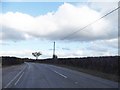
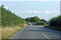
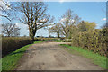
2
Road works on B3024, Forest Green
Towards Windsor.
Image: © Robin Webster
Taken: 26 Sep 2021
0.10 miles
5
Bridleway near Conigsby Farm
One of a collection of rights of way in the vicinity.
Image: © Des Blenkinsopp
Taken: 14 Apr 2018
0.18 miles
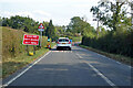
6
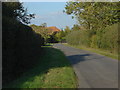
Coningsby Lane, Fifield
A view along Coningsby Lane with the roof of Grove House in the background.
Image: © Alan Hunt
Taken: 22 Oct 2011
0.20 miles
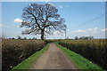
7

Footpath, Fifield
The footpath running south east from Coningsby Lane
Image: © Alan Hunt
Taken: 22 Oct 2011
0.21 miles
8
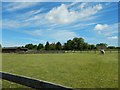
Hidden House next to Horse Farm
Viewed from the public footpath.
Image: © James Emmans
Taken: 11 Jun 2017
0.21 miles
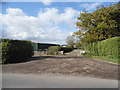
9
Track off Coningsby Lane
Farm access road and public bridleway.
Image: © Des Blenkinsopp
Taken: 14 Apr 2018
0.22 miles
10
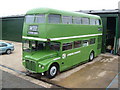
Ex- London Country Routemaster Bus.
Photographed at Private Site between Fifield & Moneyrow Green.1st September 2007
Image: © Clive Warneford
Taken: 1 Sep 2007
0.24 miles