IMAGES TAKEN NEAR TO
Bridge Avenue, MAIDENHEAD, SL6 1AF
Introduction
This page details the photographs taken nearby to Bridge Avenue, SL6 1AF by members of the Geograph project.
The Geograph project started in 2005 with the aim of publishing, organising and preserving representative images for every square kilometre of Great Britain, Ireland and the Isle of Man.

There are currently over 7.5m images from over14,400 individuals and you can help contribute to the project by visiting https://www.geograph.org.uk
Image Map
Images are licensed for reuse under creativecommons.org/licenses/by-sa/2.0
Notes
- Clicking on the map will re-center to the selected point.
- The higher the marker number, the further away the image location is from the centre of the postcode.
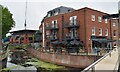
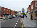
Image Listing (182 Images Found)
Images are licensed for reuse under creativecommons.org/licenses/by-sa/2.0
Image
Details
Distance
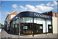
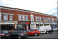
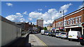
1
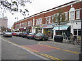
Maidenhead: High Street Colonnade
Shops on the north side of the road that used to be the main A4 through Maidenhead.
Image: © Nigel Cox
Taken: 19 Apr 2006
0.02 miles
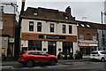

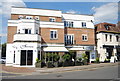
5
Part of Maidenhead town centre
Maidenhead has a pleasant town centre.
Image: © Jeremy Bolwell
Taken: 10 Jun 2014
0.03 miles