IMAGES TAKEN NEAR TO
Woodend Drive, ASCOT, SL5 9BG
Introduction
This page details the photographs taken nearby to Woodend Drive, SL5 9BG by members of the Geograph project.
The Geograph project started in 2005 with the aim of publishing, organising and preserving representative images for every square kilometre of Great Britain, Ireland and the Isle of Man.

There are currently over 7.5m images from over14,400 individuals and you can help contribute to the project by visiting https://www.geograph.org.uk
Image Map
Images are licensed for reuse under creativecommons.org/licenses/by-sa/2.0
Notes
- Clicking on the map will re-center to the selected point.
- The higher the marker number, the further away the image location is from the centre of the postcode.
Image Listing (16 Images Found)
Images are licensed for reuse under creativecommons.org/licenses/by-sa/2.0
Image
Details
Distance
2
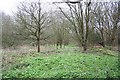
Sunninghill Woodland
Woodland view at Sunninghill
Image: © Richard Croft
Taken: 1 Apr 2008
0.10 miles
3
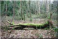
Sunninghill Woodland
Moss covered fallen tree in woodland at Sunninghill
Image: © Richard Croft
Taken: 1 Apr 2008
0.13 miles
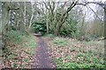
4
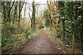
Woodland Walk
Footpath through woodland in Sunninghill
Image: © Richard Croft
Taken: 1 Apr 2008
0.16 miles
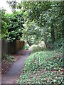
5
Woodland footpath
Woodland walk in Sunninghill
Image: © Richard Croft
Taken: 1 Apr 2008
0.16 miles
6
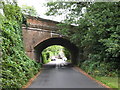
Bridge under Reading to Waterloo railway line
Image: © don cload
Taken: 2 Sep 2009
0.16 miles
7
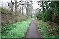
By the tracks
Footpath below the railway embankment at Sunninghill
Image: © Richard Croft
Taken: 1 Apr 2008
0.18 miles
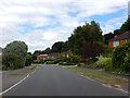
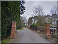
8
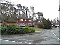
Murray Court at the junction of St Mary's Hill
Image: © David Howard
Taken: 1 Feb 2015
0.18 miles
9
Path below the railway embankment
The footpath runs alongside the line between two bridges.
Image: © don cload
Taken: 2 Sep 2009
0.19 miles
10
Friary Road
A private road (and public footpath) between Brockenhurst Road (the A330) and Coronation Road.
Image: © Oscar Taylor
Taken: 2 Apr 2023
0.20 miles