IMAGES TAKEN NEAR TO
The Glen, London Road, ASCOT, SL5 7DF
Introduction
This page details the photographs taken nearby to The Glen, London Road, SL5 7DF by members of the Geograph project.
The Geograph project started in 2005 with the aim of publishing, organising and preserving representative images for every square kilometre of Great Britain, Ireland and the Isle of Man.

There are currently over 7.5m images from over14,400 individuals and you can help contribute to the project by visiting https://www.geograph.org.uk
Image Map
Images are licensed for reuse under creativecommons.org/licenses/by-sa/2.0
Notes
- Clicking on the map will re-center to the selected point.
- The higher the marker number, the further away the image location is from the centre of the postcode.
Image Listing (31 Images Found)
Images are licensed for reuse under creativecommons.org/licenses/by-sa/2.0
Image
Details
Distance
1
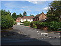
Beechcroft Close
A short cul-de-sac off the Sunninghill Road. All the properties were boarded up at the time that the photograph was taken.
Image: © Alan Hunt
Taken: 15 Jul 2012
0.05 miles
2
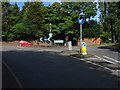
A329, The London Road
The roundabout at the junction of the Sunninghill Road with the London Road.
Image: © Alan Hunt
Taken: 15 Jul 2012
0.08 miles
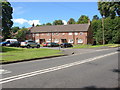
3
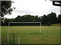
Victory Field, Sunninghill
The larger area of the field including this playing field and other leisure areas comprise Victory Field, a memorial to the men who lost their lives in the First World War.
Image: © don cload
Taken: 2 Sep 2009
0.09 miles
4
Oriental Road from the corner of Upper Village Road
Image: © David Howard
Taken: 3 Feb 2013
0.12 miles
5
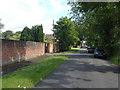
Church Lane, Sunninghill
The short access road to St Michaels and All Angels Church from the A329
Image: © Alan Hunt
Taken: 15 Jul 2012
0.12 miles
6
Kingswick Close
A short cul-de sac off the A329 The London Road
Image: © Alan Hunt
Taken: 15 Jul 2012
0.15 miles
7
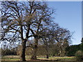
Veteran oaks at Ashurst
The line of the old road from Ascot to London is marked out by these veteran oaks (Quercus robur) on the edge of Ashurst Four Acre Field, Silwood Park
Image: © Mick Crawley
Taken: 10 Nov 2009
0.16 miles
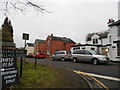
8
Looking south-southwest along Church Lane
Image: © Basher Eyre
Taken: 5 Feb 2022
0.18 miles
9
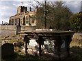
St Michael Sunninghill
The family tomb of Thomas Holloway. He built Royal Holloway College at Egham for the University of London, and Holloway Sanatorium at Virginia Water. He lived at Tittenhurst Park Sunninghill (subsequently occupied by John Lennon and Yoko Ono in the 1970s). The extension to the church (paler brickwork) was built in his honour after his death.
Image: © Mick Crawley
Taken: 13 Jan 2005
0.19 miles
10
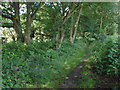
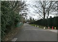
Footpath, Sunninghill
The footpath that runs west from the end of Church Lane towards Cheapside Road.
Image: © Alan Hunt
Taken: 15 Jul 2012
0.19 miles