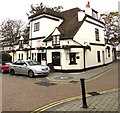
IMAGES TAKEN NEAR TO
Brocas Street, WINDSOR, SL4 6BP

Introduction

This page details the photographs taken nearby to Brocas Street, SL4 6BP by members of the Geograph project.

The Geograph project started in 2005 with the aim of publishing, organising and preserving representative images for every square kilometre of Great Britain, Ireland and the Isle of Man.

There are currently over 7.5m images from over14,400 individuals and you can help contribute to the project by visiting https://www.geograph.org.uk

Image Map


Images are licensed for reuse under creativecommons.org/licenses/by-sa/2.0
Notes
  • Clicking on the map will re-center to the selected point.
  • The higher the marker number, the further away the image location is from the centre of the postcode.

Image Listing (818 Images Found)

Images are licensed for reuse under creativecommons.org/licenses/by-sa/2.0
  • ...
Image
Details
Distance
1
Emlyn's Buildings, Eton
A strangely named row of cottages called Emlyn's Buildings in Eton by The Brocas.
Image: © Phillip Perry Taken: 27 Jul 2008
0.01 miles
2
The Boaters Inn, Eton
On the High Street - a mixture of old and new buildings, many catering for the local public school and the tourists. The pub sign shows a punter.
Image: © Colin Smith Taken: Unknown
0.02 miles
3
Atherton Court, Eton
Image: © Jonathan Thacker Taken: 13 Oct 2010
0.02 miles
4
On-street parking near Emlyns Buildings, Eton
The name sign on the wall shows EMLYNS BUILDINGS (no apostrophe).
Image: © Jaggery Taken: 24 Oct 2015
0.02 miles
5
West side of The Watermans Arms, Eton
Viewed across Brocas Street. The pub's website states that the building dates from 1542. One of its many uses was as a makeshift mortuary in 1665 during the Great Plague. Later it was a watering hole for watermen. The original Waterman's pub was next to a sawmill in nearby King Stable Street at a time when the street housed royal carriages and horses for Windsor Castle. http://www.geograph.org.uk/photo/3474540 to a view of the east side.
Image: © Jaggery Taken: 27 Apr 2013
0.02 miles
6
The Brocas, Eton
Brocus Field noticeboard and Thames Path National Trail sign. The Brocas gets its name from Sir John de Brocas, who acquired this and much other land in the area in the early 1300s. King Edward III appointed him Master of the King's Horse and later Chief Forester of Windsor Forest. The Brocas stayed in his family for generations before being given to Eton College.
Image: © Sean Davis Taken: 21 May 2010
0.03 miles
7
Bus shelter by The Waterman Arms
Image: © Basher Eyre Taken: 17 Feb 2009
0.03 miles
8
East side of The Watermans Arms, Eton
Viewed across Brocas Street. The pub's website states that the building dates from 1542. One of its many uses was as a makeshift mortuary in 1665 during the Great Plague. Later it was a watering hole for watermen. The original Waterman's pub was next to a sawmill in nearby King Stable Street at a time when the street housed royal carriages and horses for Windsor Castle. http://www.geograph.org.uk/photo/3474544 to a view of the west side.
Image: © Jaggery Taken: 27 Apr 2013
0.03 miles
9
Waterman's Arms, Brocas Street, Eton
Pub in a Grade II listed building with 17th century origins.
Image: © Jaggery Taken: 24 Oct 2015
0.03 miles
10
Eastern end of Meadow Lane
Image: © Basher Eyre Taken: 17 Feb 2009
0.03 miles
  • ...