IMAGES TAKEN NEAR TO
The Hatch, WINDSOR, SL4 5UD

Introduction

This page details the photographs taken nearby to The Hatch, SL4 5UD by members of the Geograph project.

The Geograph project started in 2005 with the aim of publishing, organising and preserving representative images for every square kilometre of Great Britain, Ireland and the Isle of Man.

There are currently over 7.5m images from over14,400 individuals and you can help contribute to the project by visiting https://www.geograph.org.uk

Image Map


Images are licensed for reuse under creativecommons.org/licenses/by-sa/2.0
Notes
  • Clicking on the map will re-center to the selected point.
  • The higher the marker number, the further away the image location is from the centre of the postcode.

Image Listing (15 Images Found)

Images are licensed for reuse under creativecommons.org/licenses/by-sa/2.0
Image
Details
Distance
1
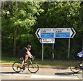
Roadsign, A308
Image: © N Chadwick Taken: 9 Jun 2019
0.08 miles
2
Grass verge, A308
Image: © N Chadwick Taken: 9 Jun 2019
0.09 miles
3
Oakley Green Road at the junction of the A308
The B3024 from Windsor parallel to the A308 now has humps the length of the road so would recommend everyone to use the A308 to head west unless they need to get somewhere on the other road.
Image: © David Howard Taken: 9 Aug 2015
0.09 miles
4
Windsor Marina
Gas and Fuel point on the Thames with eye-catching prices - diesel 117p/litre and petrol 163p/litre. www.thames-path.org.uk
Image: © Colin Smith Taken: 14 Aug 2011
0.13 miles
5
A308 Windsor Road
Towards Maidenhead from Windsor.
Image: © Robin Webster Taken: 22 Mar 2020
0.15 miles
6
Grass verge by A308
Image: © N Chadwick Taken: 9 Jun 2019
0.15 miles
7
Windsor Marina Entrance
Busy marina catering for pleasure craft, sited on the south bank of the Thames. www.thames-path.org.uk
Image: © Colin Smith Taken: 14 Aug 2011
0.15 miles
8
Windsor Marina
Image: © Steve Daniels Taken: 22 Sep 2014
0.15 miles
9
Oakley Green Road
Image: © David Howard Taken: 3 May 2015
0.16 miles
10
Eton Excelsior Rowing Club
Image: © Steve Daniels Taken: 22 Sep 2014
0.17 miles