IMAGES TAKEN NEAR TO
St. Leonards Road, WINDSOR, SL4 3DY
Introduction
This page details the photographs taken nearby to St. Leonards Road, SL4 3DY by members of the Geograph project.
The Geograph project started in 2005 with the aim of publishing, organising and preserving representative images for every square kilometre of Great Britain, Ireland and the Isle of Man.

There are currently over 7.5m images from over14,400 individuals and you can help contribute to the project by visiting https://www.geograph.org.uk
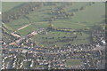
Image Map
Images are licensed for reuse under creativecommons.org/licenses/by-sa/2.0
Notes
- Clicking on the map will re-center to the selected point.
- The higher the marker number, the further away the image location is from the centre of the postcode.
Image Listing (53 Images Found)
Images are licensed for reuse under creativecommons.org/licenses/by-sa/2.0
Image
Details
Distance
1
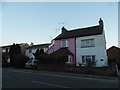
Peel Close, Windsor
Peel Close is a residential cul-de-sac in Windsor.
This image was taken in the late afternoon on a bright and sunny February day. The sun was low in the sky, casting long shadows.
Image: © Malc McDonald
Taken: 27 Feb 2022
0.01 miles
2
Peel Close, Windsor
Peel Close is a residential cul-de-sac in Windsor.
This image was taken in the late afternoon on a bright and sunny February day. The sun was low in the sky, casting long shadows, while the tree in the foreground was bare for the winter season.
Image: © Malc McDonald
Taken: 27 Feb 2022
0.02 miles
6
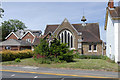
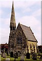
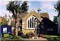
St Agnes church, Windsor
St Agnes on St Leonard's Road in the Spital area of Windsor. The church dates from 1874.
Image: © Alan Hunt
Taken: 18 Jun 2015
0.10 miles
7
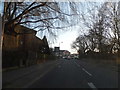
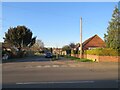
Imperial Road, Windsor
Looking towards St Leonard's Road
Image: © David Howard
Taken: 9 Mar 2014
0.10 miles
8
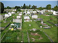
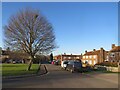
Windsor Cemetery
The cemetery was opened in 1854 as a traditional cemetery with enough room to erect a full sized memorial on every grave if required. Areas were created for both Church of England and Roman Catholic burials. The cemetery was extended along its southern edge in 1970, but is now virtually full.
Image: © Nigel Cox
Taken: 19 May 2010
0.11 miles
9
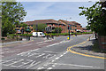
Road junction, Windsor
The junction of Imperial Road off to the left with St Leonard's Road. The junction with Hermitage Lane is in the foreground.
Image: © Alan Hunt
Taken: 18 Jun 2015
0.12 miles