
IMAGES TAKEN NEAR TO
Church Lane, SLOUGH, SL2 4NZ
Introduction
This page details the photographs taken nearby to Church Lane, SL2 4NZ by members of the Geograph project.
The Geograph project started in 2005 with the aim of publishing, organising and preserving representative images for every square kilometre of Great Britain, Ireland and the Isle of Man.

There are currently over 7.5m images from over14,400 individuals and you can help contribute to the project by visiting https://www.geograph.org.uk
Image Map
Images are licensed for reuse under creativecommons.org/licenses/by-sa/2.0
Notes
- Clicking on the map will re-center to the selected point.
- The higher the marker number, the further away the image location is from the centre of the postcode.
Image Listing (34 Images Found)
Images are licensed for reuse under creativecommons.org/licenses/by-sa/2.0
Image
Details
Distance
1
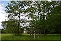
Stoke Poges: The Thomas Gray monument
Image: © Michael Garlick
Taken: 24 May 2016
0.04 miles
2
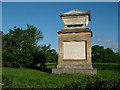
Memorial of Thomas Gray
The memorial of Thomas Gray - erected in 1788. http://www.poetsgraves.co.uk/gray.htm
Image: © Jonathan Dew
Taken: 7 May 2005
0.05 miles
3
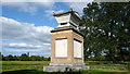
Thomas Gray Memorial
Standing near St. Giles’ Church, this five metre high monument of brick faced with Portland stone commemorates the poet Thomas Gray’s long association with the village of Stoke Poges and recognises his world-famous 'Elegy Written in a Country Churchyard'.
Composed over a number of years, the poem is believed to reference Stoke Poges, with which Gray had a close association throughout his life and in which he was known to be staying when he completed the verse in 1750.
Verses from the Elegy are inscribed on the monument, which was erected in 1799.
Image: © Mark Percy
Taken: 3 Oct 2017
0.06 miles
4
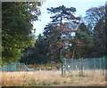
Abandoned Tennis Courts
Still marked as Sports Ground on the map, this is a continuation of the derelict sporting facilities which have been beside the footpath for nearly a kilometre.
Image: © Des Blenkinsopp
Taken: 2 Nov 2018
0.08 miles
5
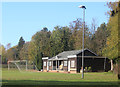
Goal Net and Pavilion
The footpath through here has just crossed an abandoned golf course past a disused driving range and derelict tennis courts. But for a change this football ground still looks to be in use.
Image: © Des Blenkinsopp
Taken: 2 Nov 2018
0.08 miles
6

Stoke Poges Memorial Gardens: early October 2025
Image: © Basher Eyre
Taken: 2 Oct 2025
0.10 miles
7
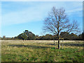
Gray's Field, Stoke Poges
Land acquired in the early 1920s by local people to preserve the environment around the monument to poet Thomas Gray. They presented it to the National Trust in 1925. https://www.nationaltrust.org.uk/features/grays-monument-and-grays-field-stoke-poges-buckinghamshire
Image: © Des Blenkinsopp
Taken: 2 Nov 2018
0.11 miles
8

Stoke Poges: St. Giles' Church: The "Gray's Elegy" churchyard
Image: © Michael Garlick
Taken: 24 May 2016
0.13 miles
9
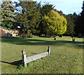
Grave Board, Stoke Poges Churchyard
A couple of these old fashioned wooden grave boards are in St Giles churchyard.
Image: © Des Blenkinsopp
Taken: 2 Nov 2018
0.15 miles
10
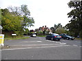
Church Lane at the junction of Park Road, Stoke Poges
Image: © David Howard
Taken: 4 Oct 2012
0.17 miles