IMAGES TAKEN NEAR TO
Rogers Lane, SLOUGH, SL2 4LE

Introduction

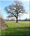
This page details the photographs taken nearby to Rogers Lane, SL2 4LE by members of the Geograph project.

The Geograph project started in 2005 with the aim of publishing, organising and preserving representative images for every square kilometre of Great Britain, Ireland and the Isle of Man.

There are currently over 7.5m images from over14,400 individuals and you can help contribute to the project by visiting https://www.geograph.org.uk

Image Map


Images are licensed for reuse under creativecommons.org/licenses/by-sa/2.0
Notes
  • Clicking on the map will re-center to the selected point.
  • The higher the marker number, the further away the image location is from the centre of the postcode.

Image Listing (12 Images Found)

Images are licensed for reuse under creativecommons.org/licenses/by-sa/2.0
Image
Details
Distance
1
Footpath junction with Rogers Lane
Image: © Shazz Taken: 17 May 2013
0.05 miles
2
Rogers Lane, Stoke Poges
Just west of the junction with the B416.
Image: © Andrew Smith Taken: 30 Apr 2006
0.11 miles
3
Footpath near Stoke Poges
SU9783 is quite well off for footpaths. The unusual suffix Poges in the village name is derived from the family name Pugeis. Hubert le Pugeis is recorded as having land here in 1255. (Oxford dictionary of place names)
Image: © Des Blenkinsopp Taken: 2 Nov 2018
0.12 miles
4
West End Lane
Image: © Colin Pyle Taken: 28 Feb 2016
0.15 miles
5
Looking south along Bells Hill
Image: © Shazz Taken: 17 May 2013
0.16 miles
6
Penn Meadow, Stoke Poges
Image: © David Howard Taken: 4 Oct 2012
0.16 miles
7
Bells Hill, Stoke Poges
Image: © David Howard Taken: 4 Oct 2012
0.16 miles
8
Path through Sefton Park
This is a well used public right of way through the now private park.
Image: © Graham Horn Taken: 23 Feb 2012
0.17 miles
9
Houses on Bells Hill, Stoke Poges
Image: © David Howard Taken: 4 Oct 2012
0.20 miles
10
Bus stop on Bells Hill, Stoke Poges
Image: © David Howard Taken: 4 Oct 2012
0.21 miles