IMAGES TAKEN NEAR TO
Cecil Road, IVER, SL0 9PS
Introduction
This page details the photographs taken nearby to Cecil Road, SL0 9PS by members of the Geograph project.
The Geograph project started in 2005 with the aim of publishing, organising and preserving representative images for every square kilometre of Great Britain, Ireland and the Isle of Man.

There are currently over 7.5m images from over14,400 individuals and you can help contribute to the project by visiting https://www.geograph.org.uk
Image Map
Images are licensed for reuse under creativecommons.org/licenses/by-sa/2.0
Notes
- Clicking on the map will re-center to the selected point.
- The higher the marker number, the further away the image location is from the centre of the postcode.
Image Listing (32 Images Found)
Images are licensed for reuse under creativecommons.org/licenses/by-sa/2.0
Image
Details
Distance
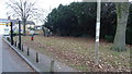
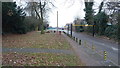
3
Path from Iver High Street to Barnfield
Image: © David Howard
Taken: 11 May 2014
0.06 miles
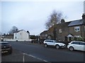
8
Saxon Court, Iver
Main entrance into Iver Park and Recreation Ground.
Image: © Rob Emms
Taken: 2 Dec 2016
0.08 miles
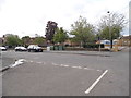
9
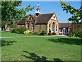
Iver Village Junior School
Iver, Buckinghamshire
Image: © Rob Emms
Taken: 8 Aug 2015
0.09 miles