
IMAGES TAKEN NEAR TO
Thorney Lane North, IVER, SL0 9HF
Introduction
This page details the photographs taken nearby to Thorney Lane North, SL0 9HF by members of the Geograph project.
The Geograph project started in 2005 with the aim of publishing, organising and preserving representative images for every square kilometre of Great Britain, Ireland and the Isle of Man.

There are currently over 7.5m images from over14,400 individuals and you can help contribute to the project by visiting https://www.geograph.org.uk
Image Map
Images are licensed for reuse under creativecommons.org/licenses/by-sa/2.0
Notes
- Clicking on the map will re-center to the selected point.
- The higher the marker number, the further away the image location is from the centre of the postcode.
Image Listing (28 Images Found)
Images are licensed for reuse under creativecommons.org/licenses/by-sa/2.0
Image
Details
Distance
1
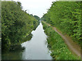
Slough Arm, Grand Union Canal
Looking east from bridge 4.
Image: © Robin Webster
Taken: 21 Jul 2013
0.09 miles
2
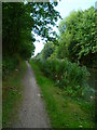
Orange Way after Wiltshire (489)
Here's a look back. The industrial buildings on the opposite bank are well hidden.
Image: © Shazz
Taken: 4 Sep 2013
0.10 miles
3
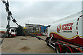
Yard, Speedy Fuels & Lubricants
Heavily defended against incursions from the canal towpath.
Image: © Robin Webster
Taken: 21 Jul 2013
0.12 miles
4
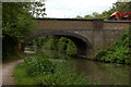
Mead's Bridge, Grand Union canal, Slough arm
Bridge number 4. The old harvester, seen in previous pictures of this bridge, is still there and can be seen in the top right.
Image: © Robert Eva
Taken: 22 Jun 2017
0.12 miles
5
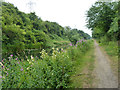
Slough Arm, Grand Union Canal
Looking east between bridges 4 and 3.
Image: © Robin Webster
Taken: 21 Jul 2013
0.12 miles
6
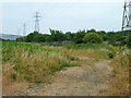
Path and pylons near Iver
The public path runs to Iver from bridge 4 on the Slough Arm, Grand Union Canal.
Image: © Robin Webster
Taken: 21 Jul 2013
0.13 miles
7
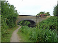
Bridge 4, Slough Arm, Grand Union Canal
A robustly built bridge which now goes nowhere for vehicles, as on the south side a heavily defended fuel depot blocks further progress, and on the north side a derelict baler blocks the way, although nothing blocks pedestrians crossing from the towpath on a public footpath.
Image: © Robin Webster
Taken: 21 Jul 2013
0.13 miles
8
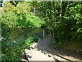
Orange Way after Wiltshire (487)
The towpath goes down a few steps here to go under a bridge.
Image: © Shazz
Taken: 4 Sep 2013
0.13 miles
9
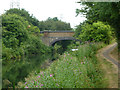
Bridge 4, Slough Arm, Grand Union Canal
An odd arrangement of the towpath here, which cannot be original. There is no clear path continuing at canal level up to the bridge, but steps descend just before the bridge to the towpath under the bridge in the normal way.
Image: © Robin Webster
Taken: 21 Jul 2013
0.13 miles
10
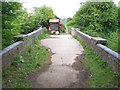
Disused bridge over canal
Bridge 4, Slough Arm, Grand Union Canal
Image: © Rob Emms
Taken: 8 May 2015
0.13 miles