IMAGES TAKEN NEAR TO
Somerset Way, IVER, SL0 9AG
Introduction
This page details the photographs taken nearby to Somerset Way, SL0 9AG by members of the Geograph project.
The Geograph project started in 2005 with the aim of publishing, organising and preserving representative images for every square kilometre of Great Britain, Ireland and the Isle of Man.

There are currently over 7.5m images from over14,400 individuals and you can help contribute to the project by visiting https://www.geograph.org.uk
Image Map
Images are licensed for reuse under creativecommons.org/licenses/by-sa/2.0
Notes
- Clicking on the map will re-center to the selected point.
- The higher the marker number, the further away the image location is from the centre of the postcode.
Image Listing (40 Images Found)
Images are licensed for reuse under creativecommons.org/licenses/by-sa/2.0
Image
Details
Distance
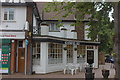
1
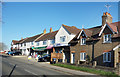
Shops on Thorney Lane South
Local shops on the edge of Richings Park.
Image: © Des Blenkinsopp
Taken: 6 Nov 2017
0.09 miles
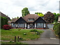
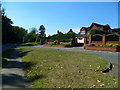
2
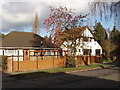
Bathurst Walk, Iver
Houses on the north side, near Thorney Lane.
Image: © David Hawgood
Taken: 21 Jan 2006
0.10 miles
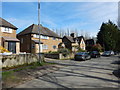
3
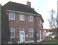
Iver Delivery Office, Royal Mail
On the corner of Thorney lane and Bathurst Walk. The Post Office has two types of sorting office, usually larger ones for sorting of collected mail, ones like this for sorting into individual delivery walks (or bicycle or van rides).
Image: © David Hawgood
Taken: 21 Jan 2006
0.10 miles
5
Thorney - Thorney Mill Lane
This must have been the original road now a residential close.
Image: © James Emmans
Taken: 25 Mar 2017
0.16 miles
8
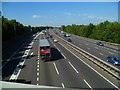
Looking north along the M25 from Thorney Mill Road
Image: © Shazz
Taken: 4 Sep 2013
0.18 miles
9
Richings Way looking west
There is no vehicular way here between the main road on the left and the housing estate road.
Image: © Shazz
Taken: 4 Sep 2013
0.18 miles
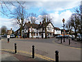
10
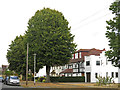
Cafe O, Iver
Close to Iver station, at the junction of Bathurst Walk and Wellesley Ave.
Image: © Robert Eva
Taken: 22 Jun 2017
0.18 miles