IMAGES TAKEN NEAR TO
Alderbourne Lane, IVER, SL0 0NT
Introduction
This page details the photographs taken nearby to Alderbourne Lane, SL0 0NT by members of the Geograph project.
The Geograph project started in 2005 with the aim of publishing, organising and preserving representative images for every square kilometre of Great Britain, Ireland and the Isle of Man.

There are currently over 7.5m images from over14,400 individuals and you can help contribute to the project by visiting https://www.geograph.org.uk
Image Map
Images are licensed for reuse under creativecommons.org/licenses/by-sa/2.0
Notes
- Clicking on the map will re-center to the selected point.
- The higher the marker number, the further away the image location is from the centre of the postcode.
Image Listing (16 Images Found)
Images are licensed for reuse under creativecommons.org/licenses/by-sa/2.0
Image
Details
Distance
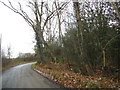
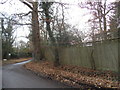
3
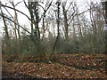
Parkspring Wood by Alderbourne Lane, Fulmer
Image: © David Howard
Taken: 9 Dec 2017
0.07 miles
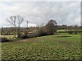
5
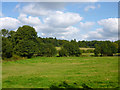
Fields by Alder Bourne
The Alder Bourne flows from left to right at the far side of the near field.
Image: © Robin Webster
Taken: 21 Sep 2014
0.09 miles
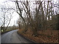
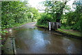
7

Alder Bourne Ford
Minor road with a stream ford.
Image: © James Emmans
Taken: 14 Jan 2019
0.18 miles
8
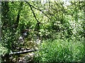
Alder Bourne
A tributary to the River Colne which in turn is a tributary to the River Thames.
Image: © Phillip Perry
Taken: 22 Jun 2008
0.18 miles
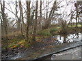
10
Alder Bourne Ford, Fulmer
This ford at Fulmer is found close to Watersplash Farm.
Image: © John Walton
Taken: 2 Jun 2013
0.19 miles