1
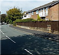
Brook Lane, Alderley Edge
Part of the B5085 to Knutsford.
Image: © Jaggery
Taken: 8 Sep 2014
0.04 miles
2
Victorian postbox in Brook Lane, Alderley Edge
Located at an entrance http://www.geograph.org.uk/photo/4172005 to Alderley Edge School for Girls
Image: © Jaggery
Taken: 8 Sep 2014
0.04 miles
3
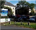
Cavendish Court, Alderley Edge
Located in Horseshoe Lane, Cavendish Court provides residential care and nursing care.
Image: © Jaggery
Taken: 8 Sep 2014
0.04 miles
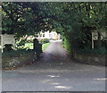
4
Brook Lane entrance to Alderley Edge School for Girls
The school is a GSA independent school for girls aged 2-18. GSA is The Girls' Schools Association,
the professional association of the heads of independent girls' schools in the UK and overseas.
GSA is a constituent member of the Independent Schools Council (ISC).
Image: © Jaggery
Taken: 8 Sep 2014
0.06 miles
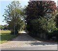
5
Leafy entrance to Alderley Edge Physiotherapy Clinic
The clinic is in Avonmore, Wilmslow Road.
Image: © Jaggery
Taken: 8 Sep 2014
0.07 miles
6
School gates, Alderley Edge
At the Wilmslow Road entrance to Alderley Edge School for Girls, an independent school for girls aged 2-18.
Image: © Jaggery
Taken: 8 Sep 2014
0.09 miles
7
Wilmslow Road looking north
Image: © Colin Pyle
Taken: 16 Apr 2013
0.10 miles
8
Aldeli, Alderley Edge
Not a flying saucer, but a New York Style Deli Restaurant in Wilmslow Road,
at the edge of a Texaco filling station. http://www.geograph.org.uk/photo/4172077 The circular roof is 25 metres across.
Image: © Jaggery
Taken: 8 Sep 2014
0.10 miles
9
Horseshoe Lane, Alderley Edge
Viewed across Wilmslow Road. The name sign on the right states that
Horseshoe Lane is a private road, not maintained by the local authority.
Image: © Jaggery
Taken: 8 Sep 2014
0.10 miles
10
Texaco filling station and car wash in Alderley Edge
Viewed across Wilmslow Road. Aldeli http://www.geograph.org.uk/photo/4172071 is on the left.
Image: © Jaggery
Taken: 8 Sep 2014
0.12 miles


