IMAGES TAKEN NEAR TO
Craig Road, STOCKPORT, SK4 2AW

Introduction

This page details the photographs taken nearby to Craig Road, SK4 2AW by members of the Geograph project.

The Geograph project started in 2005 with the aim of publishing, organising and preserving representative images for every square kilometre of Great Britain, Ireland and the Isle of Man.

There are currently over 7.5m images from over14,400 individuals and you can help contribute to the project by visiting https://www.geograph.org.uk

Image Map


Images are licensed for reuse under creativecommons.org/licenses/by-sa/2.0
Notes
  • Clicking on the map will re-center to the selected point.
  • The higher the marker number, the further away the image location is from the centre of the postcode.

Image Listing (33 Images Found)

Images are licensed for reuse under creativecommons.org/licenses/by-sa/2.0
  • ...
Image
Details
Distance
1
The Four Heatons
The Four Heatons pub on Didsbury Road in Heaton Norris was built in 1971 as the Moss Rose to replace an old pub of the same name further down towards Stockport town centre. It was built with separate cellars for mild and bitter. Twenty years ago it was thriving and shifting large quantities of Hydes Light and Bitter through electric meters. In the early 2000s, in an attempt to revitalise its fortunes, it was renamed the Four Heatons and given a surprisingly smart refurbishment, although the exterior still didn’t give a proper impression of what was inside. It closed in February 2011 and the site is earmarked for redevelopment as flats. Information source: The Pub Curmudgeon: http://pubcurmudgeon.blogspot.co.uk/2011/02/another-one-bites-dust.html
Image: © Gerald England Taken: 1 Jun 2013
0.03 miles
2
Didsbury Road Co-op
This was originally the site of The Moss Rose pub on Didsbury Road which was built in 1971 to replace an old pub of the same name further down towards Stockport town centre. In the early 2000s, in an attempt to revitalise its fortunes, it was renamed the Four Heatons Image and given a surprisingly smart refurbishment, although the exterior still didn’t give a proper impression of what was inside. It closed in February 2011. http://pubcurmudgeon.blogspot.co.uk/2011/02/another-one-bites-dust.html It was demolished in 2013 and a My Local store was built with eight two-bedroomed flats above. In 2016 it was acquired by the Co-op.
Image: © Gerald England Taken: 15 Jul 2017
0.03 miles
3
St Martin's Church, Heaton Norris
Image: © Bill Boaden Taken: 8 Oct 2013
0.05 miles
4
Russell Gardens
Sheltered housing run by the Council, and making full use of solar power.
Image: © Bill Boaden Taken: 8 Oct 2013
0.06 miles
5
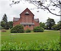
St Martin's, Norris Bank
St Martin's, Norris Bank was founded in 1901 and is now under the care of the Heaton Team Ministry which serves five churches in the area. An undated notice on the church website: http://www.stms.org.uk/ says that closure plans have been put on hold.
Image: © Gerald England Taken: 15 Jul 2017
0.07 miles
6
St Martin's, Norris Bank
St Martin's, Norris Bank was founded in 1901 and is now under the care of the Heaton Team Ministry which serves five churches in the area. Church website: http://www.stms.org.uk/
Image: © Gerald England Taken: 1 Jun 2013
0.07 miles
7
St Martin's, Norris Bank
St Martin's, Norris Bank was founded in 1901 and is now under the care of the Heaton Team Ministry which serves five churches in the area. Church website: http://www.stms.org.uk/
Image: © Gerald England Taken: 1 Jun 2013
0.07 miles
8
Crescent Park
Off Didsbury Road.
Image: © Gerald England Taken: 15 Jul 2017
0.07 miles
9
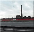
Octagonal mill chimney
Seen from the M60.
Image: © Chris Taken: 22 Apr 2013
0.07 miles
10
Mill from the M60
Image: © Anthony Parkes Taken: 9 Mar 2011
0.08 miles
  • ...