IMAGES TAKEN NEAR TO
Shaw Heath, STOCKPORT, SK3 8BP

Introduction

This page details the photographs taken nearby to Shaw Heath, SK3 8BP by members of the Geograph project.

The Geograph project started in 2005 with the aim of publishing, organising and preserving representative images for every square kilometre of Great Britain, Ireland and the Isle of Man.

There are currently over 7.5m images from over14,400 individuals and you can help contribute to the project by visiting https://www.geograph.org.uk

Image Map


Images are licensed for reuse under creativecommons.org/licenses/by-sa/2.0
Notes
  • Clicking on the map will re-center to the selected point.
  • The higher the marker number, the further away the image location is from the centre of the postcode.

Image Listing (268 Images Found)

Images are licensed for reuse under creativecommons.org/licenses/by-sa/2.0
  • ...
Image
Details
Distance
1
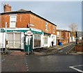
Slippery Spoon Cafe, Stockport
The cafe on the left is at 65 Shaw Heath. The name on the shuttered premises next door is Aphrodite's Greek Mediterranean Cuisine & Pizzeria.   The derelict shop on the right is on the corner of Junction Road.
Image: © Jaggery Taken: 10 Sep 2016
0.01 miles
2
Junction Road
Leading off from the junction of Shaw Heath and Longshut Lane West.
Image: © Gerald England Taken: 10 Feb 2014
0.01 miles
3
Derelict shop on a Stockport corner
The Junction Road side of the derelict shop on the corner of the B5465 Shaw Heath.
Image: © Jaggery Taken: 10 Sep 2016
0.01 miles
4
Shaw Heath
The B5465* approaching the junction with Longshut Lane West. On the right is the boarded-up Robinson's pub The Florist and next to it the former Cheshire Model Supplies shop. Both are earmarked for conversion to residential use. * Update 2020: Current mapping now shows the B5465 applied to the previously unclassified Greek Street and Waterloo Road from Edgeley to the A626 (A6188) on St Mary's Way. Shaw Heath seems to have been given the designation B6184 continuing through Cale Green until it meets the A5102. Longshut Lane West appears to be now unclassified.
Image: © Gerald England Taken: 29 Sep 2018
0.01 miles
5
Shaw Heath
The road here is called Shaw Heath and is shown on maps as being the B5465 which here turns left on to Longshut Lane West Image whilst the road ahead (still called Shaw Heath) is unclassified and leads to Cale Green. Recent online mapping however shows the B5465 applied to the previously unclassified Greek Street and Waterloo Road from Edgeley to the A626 (A6188) on St Mary's Way. Shaw Heath appears to have been given the designation B6184 continuing through Cale Green until it meets the A5102. Longshut Lane West appears to be now unclassified. On the right is the former Robinsons pub The Florist Image
Image: © Gerald England Taken: 12 Nov 2019
0.02 miles
6
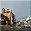
Shaw Heath
Looking down Shaw Heath, the B5465 towards Edgeley. On the left is an old Robinson's pub The Florist Image Shaw Heath continues past the box junction on the left as an unclassified road to Davenport. The B5465 takes the road off to the right (facing - a left turn for the oncoming traffic) Longshut Lane West.
Image: © Gerald England Taken: 10 Feb 2014
0.02 miles
7
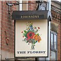
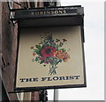
Sign of The Florist
Sign for The Florist Image
Image: © Gerald England Taken: 10 Feb 2014
0.02 miles
8
Shaw Heath
The Brooklyn pottery store holds pottery-painting sessions and parties https://www.brooklynpottery.co.uk/about-us On the right is the boarded-up Robinson's pub The Florist and next to that the former Cheshire Model Supplies shop. Both are earmarked for conversion to residential use.
Image: © Gerald England Taken: 29 Sep 2018
0.02 miles
9
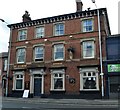
The Florist at Shaw Heath
Owned by Robinson's Brewery, just down the road, this is a Victorian pub on the B5465 Shaw Heath between Gilmore Street and Longshut Lane West.
Image: © Bobby Clegg Taken: 4 Aug 2014
0.02 miles
10
The Florist pub name sign, Shaw Heath, Stockport
Hanging from a wall bracket here. http://www.geograph.org.uk/photo/5119203
Image: © Jaggery Taken: 10 Sep 2016
0.02 miles
  • ...