IMAGES TAKEN NEAR TO
Buxton Road, HIGH PEAK, SK23 7PF

Introduction

This page details the photographs taken nearby to Buxton Road, SK23 7PF by members of the Geograph project.

The Geograph project started in 2005 with the aim of publishing, organising and preserving representative images for every square kilometre of Great Britain, Ireland and the Isle of Man.

There are currently over 7.5m images from over14,400 individuals and you can help contribute to the project by visiting https://www.geograph.org.uk

Image Map


Images are licensed for reuse under creativecommons.org/licenses/by-sa/2.0
Notes
  • Clicking on the map will re-center to the selected point.
  • The higher the marker number, the further away the image location is from the centre of the postcode.

Image Listing (72 Images Found)

Images are licensed for reuse under creativecommons.org/licenses/by-sa/2.0
  • ...
Image
Details
Distance
1
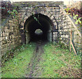
Buxton Road Tunnel, Furness Vale
Image: © Benjamin Shaw Taken: 27 Dec 2020
0.06 miles
2
Buxton Road Tunnel, Furness Vale
Image: © Benjamin Shaw Taken: 27 Dec 2020
0.06 miles
3
Tunnel under Buxton Road and the Buxton Line at Furness Vale
Image: © Benjamin Shaw Taken: 27 Dec 2020
0.06 miles
4
Looking over Furness Vale
From the path down from Kiln Knoll
Image: © Graham Hogg Taken: 22 Sep 2015
0.07 miles
5
Turner Hey Smithy Cottages wall plaque, Furness Vale, High Peak, Derbyshire
Image: © Benjamin Shaw Taken: 5 Dec 2020
0.07 miles
6
Furness Vale - view north along Peak Forest Canal
Image: © Dave Bevis Taken: 1 Apr 2002
0.08 miles
7
Looking down on Furness Vale and beyond
Image: © Chris Morgan Taken: 22 Sep 2015
0.09 miles
8
Say NO to the badger cull
A garden poster of a supporter of those against Government plans.The decision on whether to allow badger culling to curb cattle TB in England is to be delayed (February 2011).
Image: © Peter Barr Taken: 28 Feb 2011
0.09 miles
9
Footbridge No32, Peak Forest Canal
Image: © John Slater Taken: 25 May 2013
0.10 miles
10
Whaley Bridge Sewage Works
From the towpath of the Peak Forest Canal looking east. The Manchester-Sheffield railway line is visible in the midground; the River Goyt is not visible, but runs around the back of the sewage works.
Image: © Dave Dunford Taken: 12 Nov 2005
0.10 miles
  • ...