1
Splash Lane End Cottage, Brierley Green
Presumably the footpath beyond is Splash Lane, though it's not marked as such on modern maps. It leads up to Cote Bank Farm.
Image: © Dave Dunford
Taken: 2 Oct 2014
0.01 miles
2
Station Lane in Brierley Green, Buxworth
Pictured here close to its junction with Dolly Lane.
Image: © Jonathan Clitheroe
Taken: 15 Sep 2012
0.02 miles
3
Buxworth - terrace in Brierley Green
Framed by the railway bridge.
Image: © Dave Bevis
Taken: 14 Aug 2012
0.03 miles
4
Footpath in Brierley Green
Chinley House Farm in the distance.
Image: © Dave Dunford
Taken: 2 Oct 2014
0.05 miles
5
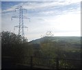
Pylon by the railway line
Image: © N Chadwick
Taken: 29 Oct 2014
0.08 miles
6
Buxworth - Brierley Green Congregational Church
For an alternative view, please see
Image
Image: © Dave Bevis
Taken: 14 Aug 2012
0.08 miles
7
Bugsworth Basin, Upper Peak Forest Canal
A view looking west of one of the arms of the basin where barges used to load limestone brought to the basin on tramways from the higher ground to the east
Image: © David Mastin
Taken: 26 Oct 2005
0.08 miles
8
Bugsworth Basin, Peak Forest Canal
Bugsworth Basin is situated at the head of navigation of the Peak Forest Canal, in the village of Buxworth, near Whaley Bridge, Derbyshire. The extensive complex was once a busy interchange between tramway and canal where boats were loaded with limestone. Bugsworth Basin was re-opened to navigation in March 2005.
Image: © Martin Clark
Taken: Unknown
0.08 miles
9
Buxworth Station (remains)
View westward, towards New Mills and Manchester (Central); ex-Midland main lines from Derby and Sheffield via Chinley to Manchester. Buxworth ('Bugsworth' until 6/30) station was closed 15/9/58; the Peak Line from Derby was closed (Matlock - Millers Dale) 6/3/67.
Image: © Ben Brooksbank
Taken: 5 May 1965
0.09 miles
10
Brierley Green
Brierley Green Methodist Church from beneath the railway bridge.
Image: © Dave Dunford
Taken: 9 Oct 2005
0.10 miles


