1
Old telephone kiosk on Bings Road, Whaley Bridge
With some of the window panes smashed and the telephone gone, it has become an anachronism and in a few years time it will no doubt disappear forever.
Image: © Neil Theasby
Taken: 4 Jun 2015
0.06 miles
2
Roosdyche
This curious flat-bottomed valley on the hillside above Whaley Bridge, some 750 metres in length, has attracted various explanations. Suggestions that it was a Roman chariot course have been dismissed, with studies in the 1960s suggesting a natural glacial origin. More recent excavations have tentatively suggested Iron Age occupation. It is crossed by footpaths at its northern and southern ends, but the valley itself is private.
Image: © Dave Dunford
Taken: 2 Oct 2014
0.09 miles
3
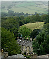
View from Roosdyche Whaley Bridge over Toddbrook Reservoir
The Roosdyche is the bed of a glacial meltway on the western slopes of Eccles Pike overlooking Whaley Bridge. The view from the pathway running alongside the Roosdyche is across Toddbrook Reservoir towards Kettleshulme.
Image: © Bob Prophet
Taken: 18 Nov 2011
0.10 miles
4
Navigation Inn, Whaley Bridge
Meeting of the Peak Forest Canal (alive) and the Cromford High Peak Tramway (dead). After the industrial heritage bit has been clocked, the Navigation will supply you with Black Sheep bitter and up to three guest beers.
Image: © al partington
Taken: 13 Feb 2007
0.13 miles
5
Reminder of Goyt Mills, Whaley Bridge
This cast-iron lintel dated 1865 with an adjoining display board serves as a reminder of these mills. The Goyt Mills Manufacturing Co Ltd was a weaving mill specialising in cotton products including splits, shirtings and cambrics. In its day it employed over 300. The mill closed in 1976.
Image: © Chris Allen
Taken: 15 Mar 2009
0.17 miles
6
One time railway bridge
Now a footbridge over the River Goyt.
Image: © philandju
Taken: 25 Oct 2018
0.17 miles
7
Goyt Mill sign, Whaley Bridge
Opened in 1865, Goyt Mill once boasted the largest one room weaving shed in England. The iron name plate in the picture was once affixed to the side of the mill. Where the mill once stood there is now a modern housing estate.
Image: © Neil Theasby
Taken: 4 Jun 2015
0.17 miles
8
Across the rooftops to the fields, Whaley Bridge
This telephoto assisted image was taken from the station footbridge. The terraced houses are in Bingswood Avenue.
Image: © Roger D Kidd
Taken: 6 Sep 2014
0.17 miles
9
The bow spring bridge over the River Goyt
The rails of the Cromford and High Peak Railway still remain in situ
Image: © Raymond Knapman
Taken: 30 Mar 2016
0.18 miles
10
Former Cromford and High Peak Railway bridge
Crossing the River Goyt at Whaley Bridge and leading away from the Peak Forest Canal in this direction.
Image: © Chris Allen
Taken: 15 Mar 2009
0.18 miles


