IMAGES TAKEN NEAR TO
Lime Gardens, Railway Street, DUKINFIELD, SK16 4LQ

Introduction

This page details the photographs taken nearby to Lime Gardens, Railway Street, SK16 4LQ by members of the Geograph project.

The Geograph project started in 2005 with the aim of publishing, organising and preserving representative images for every square kilometre of Great Britain, Ireland and the Isle of Man.

There are currently over 7.5m images from over14,400 individuals and you can help contribute to the project by visiting https://www.geograph.org.uk

Image Map


Images are licensed for reuse under creativecommons.org/licenses/by-sa/2.0
Notes
  • Clicking on the map will re-center to the selected point.
  • The higher the marker number, the further away the image location is from the centre of the postcode.

Image Listing (141 Images Found)

Images are licensed for reuse under creativecommons.org/licenses/by-sa/2.0
  • ...
Image
Details
Distance
1
Sign for the Chapel House
Although the Chapel House Image is now a freehouse, its sign still bears the name of brewer Joseph Holt.
Image: © Gerald England Taken: 14 May 2016
0.07 miles
2
Chapel House: Doorway
The doorway of the Chapel House Image
Image: © Gerald England Taken: 14 May 2016
0.07 miles
3
The Chapel House, Astley Street, Dukinfield
The Chapel House at 192 Astley Street was so-called because it was originally close to St Mary’s Church which opened in 1825 on the corner of Astley Street and Palmer Street to accommodate the growing Catholic population of Ashton who were forbidden to practise their religion there. In 1847 it closed because of subsidence caused by the nearby Dog Lane Colliery and the church moved to Zetland Street. http://shootingparrots.co.uk/2010/11/03/p-is-for-pub/ As indicated by the signage below the roofline it was originally a Groves and Whitnall's house. Later it became a Joseph Holt's house but is now a freehouse. For information on the former brewer Groves and Whitnall see http://web.archive.org/web/20160404105620/http://www.grovesandwhitnall.co.uk/ Image Image Next door is a Your Choice off licence and convenience store.
Image: © Gerald England Taken: 14 May 2016
0.07 miles
4
Chapel House
The Chapel House public house in Dukinfield.
Image: © Peter McDermott Taken: 2 Jan 2015
0.09 miles
5
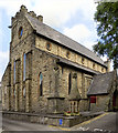
St Mark's Dukinfield
The church dates from 1849 while the Church Hall was opened in 1984.
Image: © Gerald England Taken: 11 Sep 2010
0.09 miles
6
St Mark's, Dukinfield
Viewed from Railway Street.
Image: © Gerald England Taken: 11 Sep 2010
0.10 miles
7
St Mark's Church, Dukinfield
St Mark's was completed in 1847, following the formation of the new Parish of St Mark, Dukinfield, in the previous year. The lower part of the tower dates from 1852, whilst the remainder of the tower was completed in 1881. The church is a Grade II Listed Building. A Blue Plaque dedicated to Life-long member of St Mark's, Kathy Staff (the actress best-known for her role as Nora Batty in 'Last of the Summer Wine') was placed on the wall of St Mark's Church Hall (not visible in the photo) on Monday 14 March, 2011. http://www.stmarksdukinfield.org.uk/ - St Marksdukinfield.org
Image: © David Dixon Taken: 4 Jun 2011
0.10 miles
8
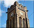
St Mark's Tower
The tower of St Mark's Image
Image: © Gerald England Taken: 11 Sep 2010
0.10 miles
9
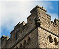
Dukinfield Gargoyle
A gargoyle on the top of the tower of St Mark's Image
Image: © Gerald England Taken: 11 Sep 2010
0.10 miles
10
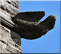
Dukinfield Gargoyle
A gargoyle on the top of the tower of St Mark's Image
Image: © Gerald England Taken: 11 Sep 2010
0.10 miles
  • ...