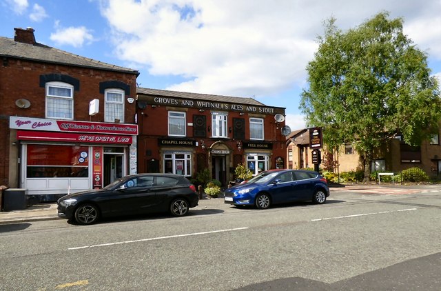
The Chapel House, Astley Street, Dukinfield
Introduction
The photograph on this page of The Chapel House, Astley Street, Dukinfield by Gerald England as part of the Geograph project.
The Geograph project started in 2005 with the aim of publishing, organising and preserving representative images for every square kilometre of Great Britain, Ireland and the Isle of Man.
There are currently over 7.5m images from over 14,400 individuals and you can help contribute to the project by visiting https://www.geograph.org.uk

Image: © Gerald England Taken: 14 May 2016
The Chapel House at 192 Astley Street was so-called because it was originally close to St Mary’s Church which opened in 1825 on the corner of Astley Street and Palmer Street to accommodate the growing Catholic population of Ashton who were forbidden to practise their religion there. In 1847 it closed because of subsidence caused by the nearby Dog Lane Colliery and the church moved to Zetland Street. http://shootingparrots.co.uk/2010/11/03/p-is-for-pub/ As indicated by the signage below the roofline it was originally a Groves and Whitnall's house. Later it became a Joseph Holt's house but is now a freehouse. For information on the former brewer Groves and Whitnall see http://web.archive.org/web/20160404105620/http://www.grovesandwhitnall.co.uk/ Image Image Next door is a Your Choice off licence and convenience store.

