IMAGES TAKEN NEAR TO
Lyme Terrace, DUKINFIELD, SK16 4JE

Introduction

This page details the photographs taken nearby to Lyme Terrace, SK16 4JE by members of the Geograph project.

The Geograph project started in 2005 with the aim of publishing, organising and preserving representative images for every square kilometre of Great Britain, Ireland and the Isle of Man.

There are currently over 7.5m images from over14,400 individuals and you can help contribute to the project by visiting https://www.geograph.org.uk

Image Map


Images are licensed for reuse under creativecommons.org/licenses/by-sa/2.0
Notes
  • Clicking on the map will re-center to the selected point.
  • The higher the marker number, the further away the image location is from the centre of the postcode.

Image Listing (300 Images Found)

Images are licensed for reuse under creativecommons.org/licenses/by-sa/2.0
  • ...
Image
Details
Distance
1
King Street
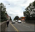
The A627 Ashton under Lyne to Hyde road through Dukinfield from Alma Bridge Image
Image: © Gerald England Taken: 23 Jul 2009
0.01 miles
2
King Street
The A627 through Dukinfield approaching Ashton-under-Lyne.
Image: © Gerald England Taken: 6 Jan 2023
0.02 miles
3
Queen Street, Dukinfield
Image: © Gerald England Taken: 16 Jun 2014
0.03 miles
4
Alderley Terrace
Block of flats off King Street, Dukinfield.
Image: © Gerald England Taken: 12 May 2010
0.05 miles
5
Alma Bridge
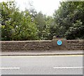
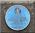
Bridge over the River Tame at the boundary between Dukinfield, Cheshire and Ashton under Lyne, Lancashire. Alma Bridge was built in 1854 and was a Toll Bar with monies collected until 26th June 1902. The blue plaque Image added in 2002 remembers local soldiers who died in the Crimea War.
Image: © Gerald England Taken: 23 Jul 2009
0.05 miles
6
Alma Bridge
Bridge over the River Tame at the boundary between Ashton under Lyne, Lancashire and Dukinfield, Cheshire. Milestone Society National ID: LA_AULDUK01cb
Image: © Gerald England Taken: 23 Jul 2009
0.07 miles
7
Dukinfield, Alma Bridge
The bridge where Cavendish Street (A627) crosses the River Tame was built in the first year of the Crimean War and was named after its first major battle, The Battle of Alma. The bridge is at the boundary between Dukinfield and Ashton, serving as a toll bar until 1902. Image]
Image: © David Dixon Taken: 27 May 2013
0.07 miles
8
King Street
The A627 through Dukinfield. The communications tower behind the bus stop was installed sometime between April and September 2021.
Image: © Gerald England Taken: 6 Jan 2023
0.07 miles
9
Crimean War (1854-56)
Plaque on Alma Bridge Image in honour of the local men of Tameside who served in the Crimean War. The bridge was built in the first year of the War and was named after the first major battle, the Battle of Alma, fought by the British and French against an unsuccessful Russian Army.
Image: © Gerald England Taken: 23 Jul 2009
0.07 miles
10
Old Boundary Marker and Bridge Marker on Alma Bridge, Tameside
County Boundary Marker and Bridge Marker inscribed in the east parapet of Alma Bridge, River Tame, on the A627 King Street. On the former boundary of Ashton-under-Lyne, Lancashire and Dukinfield, Cheshire but now entirely in an unparished area of Tameside Metropolitan District The same inscriptions can be seen in the opposite parapet. See also https://www.geograph.org.uk/photo/3493227 and https://www.geograph.org.uk/photo/1410959. Milestone Society National ID: LA_AULDUK01cb
Image: © D Garside Taken: 10 Mar 2022
0.07 miles
  • ...