IMAGES TAKEN NEAR TO
Christy Brow, SK14 4XS

Introduction

This page details the photographs taken nearby to Christy Brow, SK14 4XS by members of the Geograph project.

The Geograph project started in 2005 with the aim of publishing, organising and preserving representative images for every square kilometre of Great Britain, Ireland and the Isle of Man.

There are currently over 7.5m images from over14,400 individuals and you can help contribute to the project by visiting https://www.geograph.org.uk

Image Map


Images are licensed for reuse under creativecommons.org/licenses/by-sa/2.0
Notes
  • Clicking on the map will re-center to the selected point.
  • The higher the marker number, the further away the image location is from the centre of the postcode.

Image Listing (62 Images Found)

Images are licensed for reuse under creativecommons.org/licenses/by-sa/2.0
  • ...
Image
Details
Distance
1
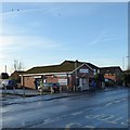
Newton Pharmacy
Previously Newton Library Image
Image: © Gerald England Taken: 5 Jan 2015
0.07 miles
2
Newton Library Bus Stop
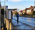
The bus stop on Talbot Road is still listed as Newton Library although the library closed in 2012 Image and has since been converted into a pharmacy Image
Image: © Gerald England Taken: 5 Jan 2015
0.07 miles
3
Newton Pharmacy
The pharmacy on Talbot Road was formerly the library Image
Image: © Gerald England Taken: 5 Jan 2015
0.07 miles
4
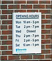
Opening Hours at Newton Library
But not for much longer. As from October 12th 2012 everyday will be Wednesday as Newton Library Image is to close as part of council cut-backs.
Image: © Gerald England Taken: 27 Sep 2012
0.07 miles
5
Newton Library
Local library off Talbot Road - due to close in October 2012 owing to council cut-backs. Image
Image: © Gerald England Taken: 27 Sep 2012
0.07 miles
6
Contrails over Talbot Road
On a bright sunny winter morning there appears to be more traffic in the sky than on the road.
Image: © Gerald England Taken: 5 Jan 2015
0.08 miles
7
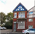
Former Reform Club
The former Newton Reform Club Image, otherwise known as Newton Moor Liberal Club. dates from 1909. It closed around 2016 Image and has now been converted into a residential property,
Image: © Gerald England Taken: 20 Sep 2019
0.09 miles
8
Newton Moor Liberal Club 1909
Now known as Newton Reform Club Image
Image: © Gerald England Taken: 27 Sep 2012
0.10 miles
9
Newton Reform Club
Otherwise known as Newton Moor Liberal Club. The sign in the stonework Image dates the building as 1909.
Image: © Gerald England Taken: 27 Sep 2012
0.11 miles
10
Newton Pharmacy
Newton Library Image closed in 2012 and his since become Newton Pharmacy Image A sign still asks DRIVERS: Please drive carefully and be aware of pedestrians leaving the library.
Image: © Gerald England Taken: 20 Sep 2019
0.12 miles
  • ...