IMAGES TAKEN NEAR TO
Bunkers Hill Road, HYDE, SK14 3QA

Introduction

This page details the photographs taken nearby to Bunkers Hill Road, SK14 3QA by members of the Geograph project.

The Geograph project started in 2005 with the aim of publishing, organising and preserving representative images for every square kilometre of Great Britain, Ireland and the Isle of Man.

There are currently over 7.5m images from over14,400 individuals and you can help contribute to the project by visiting https://www.geograph.org.uk

Image Map


Images are licensed for reuse under creativecommons.org/licenses/by-sa/2.0
Notes
  • Clicking on the map will re-center to the selected point.
  • The higher the marker number, the further away the image location is from the centre of the postcode.

Image Listing (43 Images Found)

Images are licensed for reuse under creativecommons.org/licenses/by-sa/2.0
  • ...
Image
Details
Distance
1
Stockport Road
Stockport Road as seen from Idle Hill, Hattersley Viaduct is towards the bottom of the photograph, the green viaduct takes the A560 over the Manchester to Glossop rail line.
Image: © Stephen Burton Taken: 15 Apr 2021
0.03 miles
2
New Apartments
Apartments under construction as part of the ongoing successful regeneration of the Hattersley district, the regeneration started around the year 2000 and there is still several years remaining until its completion.
Image: © Stephen Burton Taken: 28 Jan 2016
0.05 miles
3
Houses on Hattersley Estate
Image: © Anthony Parkes Taken: 19 Jul 2010
0.12 miles
4
Stockport Road, Hattersley
At least, much of Hattersley has a feeling of space. The hill behind is Werneth Low.
Image: © Bill Boaden Taken: 27 Apr 2010
0.13 miles
5
Chapman Arms
On the corner of Stockport Road and Chapman Road, Hattersley. It is named after John Chapman http://en.m.wikipedia.org/wiki/John_Chapman_(1810%E2%80%931877) who was Lord of the manor of Hattersley. Image
Image: © Gerald England Taken: 22 Mar 2011
0.18 miles
6
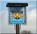
Sign of the Chapman Arms
Sign for the Chapman Arms, Hattersley Image
Image: © Gerald England Taken: 22 Mar 2011
0.18 miles
7
The Chapman Arms Hattersley
The Chapman Arms built in the late 1960s called time gentlemen please for the last time in 2014, the public house was owned by Robinsons a local brewer with pubs in the North West and Wales. The building replaced the old Chapman Arms that stood on the grass verge in the foreground of this photograph, the old pub remained open during the building of the new. So this closure marks the sad demise of a very many years of hospitality on this site.
Image: © Stephen Burton Taken: 3 Feb 2015
0.18 miles
8
Chapman Arms, Hattersley
On the corner of Stockport Road (A560) and Clough End Road.
Image: © John Topping Taken: 24 Oct 2013
0.18 miles
9
Tameside Court, Hattersley
Tameside Court tower block due to be demolished in the next twelve month's, according to a local resident.
Image: © John Topping Taken: 24 Oct 2013
0.18 miles
10
Hattersley Community Centre
Off Hattersley Road East.
Image: © Gerald England Taken: 16 May 2011
0.19 miles
  • ...