IMAGES TAKEN NEAR TO
Crossbridge Road, HYDE, SK14 2SU

Introduction

This page details the photographs taken nearby to Crossbridge Road, SK14 2SU by members of the Geograph project.

The Geograph project started in 2005 with the aim of publishing, organising and preserving representative images for every square kilometre of Great Britain, Ireland and the Isle of Man.

There are currently over 7.5m images from over14,400 individuals and you can help contribute to the project by visiting https://www.geograph.org.uk

Image Map


Images are licensed for reuse under creativecommons.org/licenses/by-sa/2.0
Notes
  • Clicking on the map will re-center to the selected point.
  • The higher the marker number, the further away the image location is from the centre of the postcode.

Image Listing (160 Images Found)

Images are licensed for reuse under creativecommons.org/licenses/by-sa/2.0
  • ...
Image
Details
Distance
1
Crossbridge Road
Off St Paul's Hill Road.
Image: © Gerald England Taken: 3 Aug 2015
0.01 miles
2
The top of St Paul's Hill Road
On the left is Crossbridge Road Image Across the bridge ahead is Green Lane Image
Image: © Gerald England Taken: 3 Aug 2015
0.03 miles
3
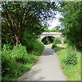
Green Lane Bridge
Over the former Godley Junction to Apethorn railway (now used by the Trans Pennine Trail and National Cycle Network Route #62).
Image: © Gerald England Taken: 3 Aug 2015
0.03 miles
4
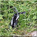
Package by the trail
The Trans Pennine Trail (and National Cycle Network Route #62) along the trackbed of the former Godley Junction to Apethorn railway line is used by many people who are walking dogs. It may not have been the group who are just passing under Green Lane bridge but someone has left a package Image by the side of the trail (bottom left).
Image: © Gerald England Taken: 3 Aug 2015
0.03 miles
5
A bagfull of ****
This bag was by the side of the Trans Pennine Trail near Green Lane Image There were other similar packages to be seen in various other places. Why go to the trouble of bagging your dog's droppings (and I'm assuming it was that and not something else) and then abandon it by the side of the trail instead of disposing of it somewhere appropriate? Better surely to leave it unbagged and let it decompose naturally - or did you bag it because someone was watching and toss it when you thought no-one was?
Image: © Gerald England Taken: 3 Aug 2015
0.03 miles
6
Green Lane Bridge
Bridge over the former Godley to Apethorn railway line. The new houses are on St Pauls Hill Road.
Image: © Gerald England Taken: 31 May 2011
0.04 miles
7
Green Lane Bridge
The former Godley to Apethorn Railway line has been reclaimed for the Trans Pennine Trail and National Cycle Route #62. The bridge at Green Lane has two archways. West of Green Lane the line became single-track. East of Green Lane were sidings and a turntable now totally overgrown. The double arch here allows good separation on the trail between cyclists/walkers and horseriders. Image
Image: © Gerald England Taken: 22 Jul 2013
0.04 miles
8
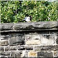
Magpie on Green Lane Bridge
A magpie on Image
Image: © Gerald England Taken: 22 Jul 2013
0.04 miles
9
Green Lane Bridge (detail)
Detail in the stonework of Green Lane Bridge Image
Image: © Gerald England Taken: 24 Mar 2009
0.04 miles
10
Green Lane Bridge
Over the former Godley to Apethorn railway line, now part of the Trans Pennine Trail.
Image: © Gerald England Taken: 12 Apr 2010
0.05 miles
  • ...