Green Lane Bridge
Introduction
The photograph on this page of Green Lane Bridge by Gerald England as part of the Geograph project.
The Geograph project started in 2005 with the aim of publishing, organising and preserving representative images for every square kilometre of Great Britain, Ireland and the Isle of Man.

There are currently over 7.5m images from over 14,400 individuals and you can help contribute to the project by visiting https://www.geograph.org.uk
Green Lane Bridge
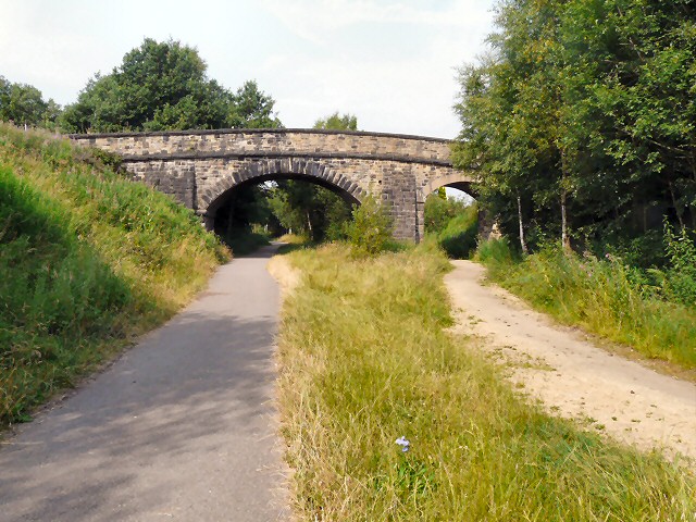
Image: © Gerald England Taken: 22 Jul 2013
The former Godley to Apethorn Railway line has been reclaimed for the Trans Pennine Trail and National Cycle Route #62. The bridge at Green Lane has two archways. West of Green Lane the line became single-track. East of Green Lane were sidings and a turntable now totally overgrown. The double arch here allows good separation on the trail between cyclists/walkers and horseriders. Image
Images are licensed for reuse under creativecommons.org/licenses/by-sa/2.0
Image Location
Latitude
53.448688
Longitude
-2.06049