IMAGES TAKEN NEAR TO
Manchester Road, HYDE, SK14 2DE

Introduction

This page details the photographs taken nearby to Manchester Road, SK14 2DE by members of the Geograph project.

The Geograph project started in 2005 with the aim of publishing, organising and preserving representative images for every square kilometre of Great Britain, Ireland and the Isle of Man.

There are currently over 7.5m images from over14,400 individuals and you can help contribute to the project by visiting https://www.geograph.org.uk

Image Map


Images are licensed for reuse under creativecommons.org/licenses/by-sa/2.0
Notes
  • Clicking on the map will re-center to the selected point.
  • The higher the marker number, the further away the image location is from the centre of the postcode.

Image Listing (128 Images Found)

Images are licensed for reuse under creativecommons.org/licenses/by-sa/2.0
  • ...
Image
Details
Distance
1
Manchester Road
The A57 into Hyde between Broomstair Bridge and Kingston Bridge. Bridge Field Terrace on the left was built in 1872 Image
Image: © Gerald England Taken: 4 Mar 2019
0.01 miles
2
Bridge Field Terrace 1872
Name and date stone on Bridge Field Terrace Image
Image: © Gerald England Taken: 4 Mar 2019
0.01 miles
3
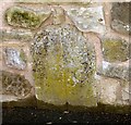
Old Bridge Marker by the A57, Manchester Road
Bridge Marker by the A57, in parish of Hyde (Tameside District), Manchester Road, set in low stone wall approximately 100 yards east of Broomstair Bridge, and opposite 230 Manchester Road. The wall was rebuilt in the summer of 2017 so the surrounding stonework is now different. The letter 'C' on the stone may indicate the responsibility of the former Cheshire County Council to maintain the road up to and including Broomstair Bridge. There is a similar stone further east nearer the bridge over Wilson Brook Image Surveyed Milestone Society National ID: CH_MAHY06br.
Image: © Milestone Society Taken: Unknown
0.02 miles
4
Old bridge marker post
Set into the bottom of the wall Image on Manchester Road Image is an old stone marker post. This is the same stone photographed by the Milestone Society Image in 2017 who describe it as a "Bridge Marker". The wall was heightened during 2017 and the stone has been reset within the wall. The stone appears to be one of a pair as further along the road Image halfway towards Kingston Bridge Image is a similar stone Image but with a letter "C" on the left. I thought at first the other may have been meant to mark the boundary between Cheshire and Lancashire with the letter C on the left but the actual boundary between Cheshire and Lancashire is at Broomstair Bridge Image I have now been informed that the C refers to County, not to Cheshire. This type of bridge marker denotes the extent of the road, normally 100 yards, leading up to a bridge that the County, rather than the parish, was responsible for maintaining. Examples of C stones can be found all round the country, and sometimes a pair still exists, one on each side of the bridge. The Milestone Society categorise them as bridge markers.
Image: © Gerald England Taken: 4 Mar 2019
0.02 miles
5
Manchester Road
The A57 at Kingston. On the right is grazing land on the flood plain between Wilson Brook and the River Tame. In the wall, which was heightened in 2017, is an old stone marker post Image
Image: © Gerald England Taken: 4 Mar 2019
0.02 miles
6
A57 approaching Broomstair Bridge
Broomstair bridge over the River Tame was originally the boundary between Hyde, Cheshire and Denton, Lancashire. Now both towns are part of Tameside Metropolitan Borough. Beyond the boundary sign are two warning road signs. One refers to horses which is not surprising as there is a stables on the left hand side and a bridleway on the opposite side of the road. The other sign warns of cattle!
Image: © Gerald England Taken: 1 Dec 2014
0.02 miles
7
Wall opposite Bridge Field Terrace
This wall on Manchester Road Image is opposite Bridge Field Terrace Image Over the wall is grazing land on the flood plain between Wilson Brook and the River Tame. In the wall, which was heightened in 2017, is an old stone marker post Image
Image: © Gerald England Taken: 4 Mar 2019
0.02 miles
8
Manchester Road
The A57 towards Hyde just past the Denton boundary at Broomstair. On the left is the Riverside Care Home.
Image: © Gerald England Taken: 4 Feb 2019
0.03 miles
9
Hall Street
A cul-de-sac off Manchester Road Image I understand it was once called Scholes Street.
Image: © Gerald England Taken: 1 Dec 2014
0.03 miles
10
Manchester Road, Kingston
The A57 at its junction with Hall Street Image
Image: © Gerald England Taken: 1 Dec 2014
0.03 miles
  • ...