IMAGES TAKEN NEAR TO
Bank Street, HYDE, SK14 2AN

Introduction

This page details the photographs taken nearby to Bank Street, SK14 2AN by members of the Geograph project.

The Geograph project started in 2005 with the aim of publishing, organising and preserving representative images for every square kilometre of Great Britain, Ireland and the Isle of Man.

There are currently over 7.5m images from over14,400 individuals and you can help contribute to the project by visiting https://www.geograph.org.uk

Image Map


Images are licensed for reuse under creativecommons.org/licenses/by-sa/2.0
Notes
  • Clicking on the map will re-center to the selected point.
  • The higher the marker number, the further away the image location is from the centre of the postcode.

Image Listing (1085 Images Found)

Images are licensed for reuse under creativecommons.org/licenses/by-sa/2.0
  • ...
Image
Details
Distance
1
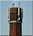
A surviving chimney
The chimney behind the former Winterbotham's tripe dressing factory on Bank Street has escaped demolition due its use as a support for mobile phone relay masts.
Image: © Gerald England Taken: 2 Jun 2007
0.01 miles
2
Hyde Industrial Supplies
Industrial supply shop on Clark Way. The site was formerly Winterbotham's tripe dressing factory and old mill chimney has survived only as housing for mobile phone masts Image On the left is the "Pit Stop" mobile sandwich bar.
Image: © Gerald England Taken: 8 Nov 2012
0.01 miles
3
Winterbotham's Chimney
The chimney was formerly part of Winterbotham's tripe dressing factory on Bank Street. Its current role is as housing for mobile phone masts.
Image: © Gerald England Taken: 10 Apr 2011
0.02 miles
4
Clark Way
The Northern bypass around Hyde.
Image: © Gerald England Taken: 13 Jul 2011
0.04 miles
5
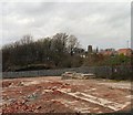
Site of Carrfield Mill
Looking across the site of Carrfield Mill Image On the left of the reservoirs are new houses Image built on the Ashton Bros Mill site, demolished in 2008. Visible on the right through the trees is Winterbotham's chimney Image
Image: © Gerald England Taken: 4 Feb 2013
0.04 miles
6
King Street
Little now exists on King Street. Its Southern link to George Street and the rest of town was destroyed when the m67 motorway was driven through in the late 70s. Now it just provides access from Clark Way to a couple of properties on Grafton Street. Across Clark Way is a builders merchant and timber yard. The old mill chimney Image belonged to Winterbotham's tripe dressing factory on Bank Street.
Image: © Gerald England Taken: 10 Apr 2011
0.05 miles
7
Towards Flowery Field Church
Looking over a recently cleared industrial site from Clarendon Street towards Flowery Field Church. On the right are houses built on the site of the former Ashton Bros Mill.
Image: © Gerald England Taken: 7 Dec 2009
0.05 miles
8
Grafton Street
At one time a street of terraced houses but since the coming of the M67 motorway it is home now only to the Bangla City restaurant and the Grafton Centre Image
Image: © Gerald England Taken: 7 Jul 2011
0.06 miles
9
Grafton Centre
The Grafton Centre is Tameside's 1st Active Ageing Centre which hosts a wide variety of activities for the over 55s living within the community to enhance their overall health and wellbeing. http://www.tameside.gov.uk/graftoncentre The centre hosts a luncheon club that meets daily Monday to Friday at 12 noon serving a two course lunch at very reasonable price. It used to be known as the "Pensioners' Club".
Image: © Gerald England Taken: 7 Jul 2011
0.06 miles
10
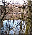
Mill pond at former Carrfield Mill
View through the trees from the side of Clark Way of the mill pond at the former Carrfield Mill which has been demolished over the last two years. In the background are new houses which were built on the site of the former Ashton Bros mill which was demolished in 2008.
Image: © Gerald England Taken: 23 Feb 2015
0.06 miles
  • ...