IMAGES TAKEN NEAR TO
Market Street, GLOSSOP, SK13 8AX

Introduction

This page details the photographs taken nearby to Market Street, SK13 8AX by members of the Geograph project.

The Geograph project started in 2005 with the aim of publishing, organising and preserving representative images for every square kilometre of Great Britain, Ireland and the Isle of Man.

There are currently over 7.5m images from over14,400 individuals and you can help contribute to the project by visiting https://www.geograph.org.uk

Image Map


Images are licensed for reuse under creativecommons.org/licenses/by-sa/2.0
Notes
  • Clicking on the map will re-center to the selected point.
  • The higher the marker number, the further away the image location is from the centre of the postcode.

Image Listing (257 Images Found)

Images are licensed for reuse under creativecommons.org/licenses/by-sa/2.0
  • ...
Image
Details
Distance
1
High Street West, Glossop
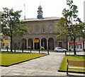
The Town Hall is topped by a distinctive clock tower. Its arcaded and colonnaded ground floor is now used as a small shopping precinct. Woolworths is about to close its doors for the last time. Cohen's Chemists bears the coat of arms of the Norfolk family.
Image: © Gerald England Taken: 24 Dec 2008
0.01 miles
2
Glossop Market
On Fridays and Saturdays the market outside the Glossop Market Hall is thronged with people shopping at the busy stalls. Earlier in the week when there is no market on the place is deserted.
Image: © Gerald England Taken: 17 Nov 2009
0.01 miles
3
The town hall Glossop
Image: © Raymond Knapman Taken: 24 Jun 2011
0.01 miles
4
High Street West, Glossop
Looking east toward the town hall. The opticians in the foreground (on the corner of Market Street) was once a pub called The Newmarket. In the mid-eighties it closed with what (for me as a vegetarian beer-lover) can only be said to be the worst of fates - it reopened as a Dewhurst's butchers shop.
Image: © David Lally Taken: 13 Aug 2009
0.02 miles
5
A57 High Street West, Glossop
Image: © Colin Pyle Taken: 19 Jan 2014
0.02 miles
6
Glossop Town Hall
From Norfolk Square. The Town Hall is topped by a distinctive clock tower. Its arcaded and colonnaded ground floor is now used as a small shopping precinct.
Image: © Gerald England Taken: 28 Jun 2009
0.02 miles
7
Norfolk Street, Glossop
Looking North along the B6105 (Norfolk Street) as it meets the junction of the A57 (High Street East) with the A624 (Victoria Street).
Image: © Darren Haddock Taken: 18 Oct 2006
0.02 miles
8
Glossop
Looking down on Glossop from the Snake Road. Dinting Viaduct is just visible on the edge of the cloud inversion.
Image: © Peter McDermott Taken: 11 Nov 2023
0.02 miles
9
Memorial plaque on Glossop Town Hall
On the side of Glossop Town Hall Image a memorial plaque reads: BOROUGH OF GLOSSOP THE TOWN HALL AND MARKET AND CERTAIN MANORIAL RIGHTS AND FRANCHISES WERE PURCHASED FROM LORD HOWARD OF GLOSSOP AND GENEROUSLY PRESENTED TO THE CORPORATION OF ~ GLOSSOP BY ~ ~ ~ Mr & Mrs ISAAC JACKSON HOLLY MOUNT GLOSSOP IN MEMORY OF THE MEN OF GLOSSOP AND DISTRICT WHO SERVED IN THE GREAT WAR (1914 - 1918)
Image: © Gerald England Taken: 28 Jun 2009
0.02 miles
10
Former Co-op Department Store
When the Co-op finally moved out in about 1985 the front section, which as can be seen is now a Costa Coffee shop, became a NorWeb http://en.wikipedia.org/wiki/NORWEB showroom. The upper floors and the sections nearest Henry Street are occupied by Thermal Transfer, a heating and ventilation company.
Image: © David Lally Taken: 13 Aug 2009
0.02 miles
  • ...