IMAGES TAKEN NEAR TO
Millgate, STOCKPORT, SK1 2LX

Introduction

This page details the photographs taken nearby to Millgate, SK1 2LX by members of the Geograph project.

The Geograph project started in 2005 with the aim of publishing, organising and preserving representative images for every square kilometre of Great Britain, Ireland and the Isle of Man.

There are currently over 7.5m images from over14,400 individuals and you can help contribute to the project by visiting https://www.geograph.org.uk

Image Map


Images are licensed for reuse under creativecommons.org/licenses/by-sa/2.0
Notes
  • Clicking on the map will re-center to the selected point.
  • The higher the marker number, the further away the image location is from the centre of the postcode.

Image Listing (1328 Images Found)

Images are licensed for reuse under creativecommons.org/licenses/by-sa/2.0
  • ...
Image
Details
Distance
1
Stockport Marketplace
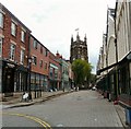
The North side of the Market Place looking towards St Mary's.
Image: © Gerald England Taken: 28 Jul 2009
0.01 miles
2
Stockport's Flatiron
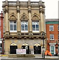
A locally listed building at 6-10 Millgate. Records suggest that this building may have been the premises of a wholesale grocery business in the late 19th century. The building is of brick with stone dressings, of four storeys, with a full-height loading slot, left side. The ground floor was of stone but much of it has been replaced in brick, late 20th century. Deep bracketed eaves course, stone quoins. The building is canted to the curve of the street, and there are quoins at this point. Windows are generally in ornamented stone surrounds, those of the first and second floor with a sill band. The Italianate architectural style is closely related to commercial warehouse design in late 19th century Manchester typified by warehouses of the 1860s-80s by the firm Clegg & Knowles. Until recently it was occupied by Gorvins Solicitors. The passageway behind, Folley, originally leads to the site of the Warren Almshouses Image
Image: © Gerald England Taken: 30 Mar 2013
0.01 miles
3
Air conditioning units, rear of Millgate
For some background to this site and a better understanding of the space, see Image and Image The Folley is seen in Image
Image: © Robin Stott Taken: 17 Mar 2012
0.01 miles
4
The Folley
A passageway called The Folley Image led between Millgate and the rear of St Mary's church to the site of the Warrens Alms Houses. The former solicitor's offices on the left Image have now been converted into flats. The passageway has been tidied up and a gate erected.
Image: © Gerald England Taken: 31 May 2019
0.01 miles
5
The Folley
A passageway called The Folley Image leads between Millgate Image and rear of St Mary's church Image to the site of the Warren Almshouses Image
Image: © Gerald England Taken: 30 Mar 2013
0.01 miles
6
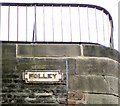
Folley (street sign)
Street sign for the passageway Image off Millgate, underneath St Mary's church, leading to the former Warren Almshouses.
Image: © Gerald England Taken: 22 Apr 2013
0.01 miles
7
Millgate from Folley
Looking down the passageway Folley Image from the site of the Warren Almshouses Image towards Millgate. On the left is the churchyard of St Mary's from where there is a view of the air conditioning units Image on the side of the former Golvin's solicitors building Image
Image: © Gerald England Taken: 22 Apr 2013
0.01 miles
8
Hen Market
The former "Hen Market" building on Stockport Market Place is now used as a "Food Hall".
Image: © Gerald England Taken: 14 Apr 2011
0.01 miles
9
Floodlight housings, St Mary's churchyard
They bear a slight resemblance to Stockport's Market Hall in the background.
Image: © Robin Stott Taken: 17 Mar 2012
0.01 miles
10
St Mary's Churchyard
The two trees on the right are weeping silver pear trees. The scientific name is Pyrus salicifolia 'Pendula'. Salicifolia means leaves like willow leaves. The species comes from the Middle East.
Image: © Gerald England Taken: 30 Sep 2017
0.01 miles
  • ...