IMAGES TAKEN NEAR TO
London Road North, STOCKPORT, SK12 1QZ

Introduction

This page details the photographs taken nearby to London Road North, SK12 1QZ by members of the Geograph project.

The Geograph project started in 2005 with the aim of publishing, organising and preserving representative images for every square kilometre of Great Britain, Ireland and the Isle of Man.

There are currently over 7.5m images from over14,400 individuals and you can help contribute to the project by visiting https://www.geograph.org.uk

Image Map


Images are licensed for reuse under creativecommons.org/licenses/by-sa/2.0
Notes
  • Clicking on the map will re-center to the selected point.
  • The higher the marker number, the further away the image location is from the centre of the postcode.

Image Listing (59 Images Found)

Images are licensed for reuse under creativecommons.org/licenses/by-sa/2.0
  • ...
Image
Details
Distance
1
Queuing for the bus
Poynton folks waiting for a morning bus into Stockport.
Image: © Jonathan Billinger Taken: 3 Dec 2008
0.02 miles
2
A523/A5149 junction, Poynton
Follow the link http://www.geograph.org.uk/photo/2935971 to learn what is novel in this view.
Image: © Peter Turner Taken: 6 May 2012
0.04 miles
3
Jubilee Fountain plaque
See Image
Image: © Mike Kirby Taken: 29 Aug 2009
0.04 miles
4
The Jubilee Fountain (2)
Another view of the fountain. SeeImage
Image: © Mike Kirby Taken: 29 Aug 2009
0.04 miles
5
The Jubilee Fountain and Lamp Standard, Fountain Place
The Jubilee Fountain and Lamp Standard was erected to celebrate Queen Victoria's Jubilee in 1897 to both refresh horses, other animals and people with water, and provide gaslight at a very busy junction. This grade II listed structure consists of a plinth with moulded panels surrounding lion’s mask fountains on three faces, which originally emptied into square, then semi-circular basins, and finally into the bowls beneath. The information plaque sits on the fourth face. The column had four direction plates (since removed), and supports four, (originally gas) lamps which, incidentally was the first street lighting in Poynton.
Image: © Mike Kirby Taken: 29 Aug 2009
0.04 miles
6
1-13, Fountain Place
Built in a vernacular revival style, around the junction of Chester Road and London Road North, this early twentieth century row of shops, is classed as a locally important building. The Jubilee fountain can be seen right of the centre lamp standard. SeeImage
Image: © Mike Kirby Taken: 29 Aug 2009
0.04 miles
7
Park Lane, Poynton
From near to the junction with the A523 as can be seen by the unusual road surfaces http://www.geograph.org.uk/photo/2935971.
Image: © Peter Turner Taken: 6 May 2012
0.04 miles
8
Diamond Jubilee commemorative fountain, Poynton
Image: © Christopher Hilton Taken: 31 Dec 2022
0.04 miles
9
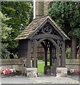
Lych gate, Church of St. George, London Road
The carving on the beam above the entrance arch reads 'There is Rest amid Labour, Calm amid Storm, Hope in Death'
Image: © Mike Kirby Taken: 29 Aug 2009
0.04 miles
10
Poynton 'centreville'
Junction of A5149 with A523. A very busy road junction that had traffic lights until recently when a radical piece of traffic engineering was instituted. On the four roads a hundred or so yards out the normal road surface, kerbs and pavements cease. The double lanes for right turns removed and a single lane marked by a different road surface and paving blocks in differing colours mark the gutters and pavement, the edge of which is only slightly raised. It feels like the road layouts in a pedestrian area. In fact no one has right of way, pedestrian or vehicle. No black and white pedestrian crossing markings. No give way signs. Two interlinked roundabouts, necessary because the slightly staggered roads across the A523, are marked by different coloured paving blocks indicating the route for traffic circulation. It seems to be working and is something of a local wonder to be visited and observed. Update: There is a 15min video about the concept and its implementation http://www.youtube.com/watch?v=-vzDDMzq7d0
Image: © Peter Turner Taken: 6 May 2012
0.05 miles
  • ...