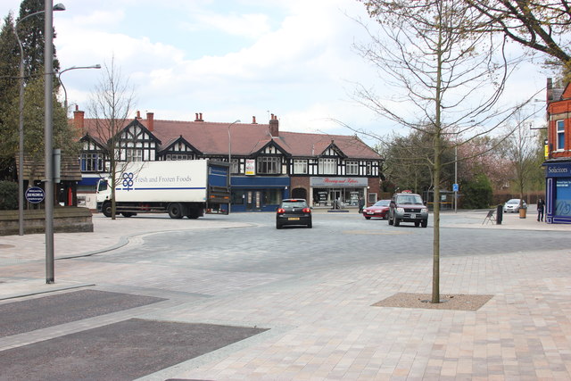
Poynton 'centreville'
Introduction
The photograph on this page of Poynton 'centreville' by Peter Turner as part of the Geograph project.
The Geograph project started in 2005 with the aim of publishing, organising and preserving representative images for every square kilometre of Great Britain, Ireland and the Isle of Man.
There are currently over 7.5m images from over 14,400 individuals and you can help contribute to the project by visiting https://www.geograph.org.uk

Image: © Peter Turner Taken: 6 May 2012
Junction of A5149 with A523. A very busy road junction that had traffic lights until recently when a radical piece of traffic engineering was instituted. On the four roads a hundred or so yards out the normal road surface, kerbs and pavements cease. The double lanes for right turns removed and a single lane marked by a different road surface and paving blocks in differing colours mark the gutters and pavement, the edge of which is only slightly raised. It feels like the road layouts in a pedestrian area. In fact no one has right of way, pedestrian or vehicle. No black and white pedestrian crossing markings. No give way signs. Two interlinked roundabouts, necessary because the slightly staggered roads across the A523, are marked by different coloured paving blocks indicating the route for traffic circulation. It seems to be working and is something of a local wonder to be visited and observed. Update: There is a 15min video about the concept and its implementation http://www.youtube.com/watch?v=-vzDDMzq7d0

