IMAGES TAKEN NEAR TO
Albert Terrace, STOCKPORT, SK1 1EL

Introduction

This page details the photographs taken nearby to Albert Terrace, SK1 1EL by members of the Geograph project.

The Geograph project started in 2005 with the aim of publishing, organising and preserving representative images for every square kilometre of Great Britain, Ireland and the Isle of Man.

There are currently over 7.5m images from over14,400 individuals and you can help contribute to the project by visiting https://www.geograph.org.uk

Image Map


Images are licensed for reuse under creativecommons.org/licenses/by-sa/2.0
Notes
  • Clicking on the map will re-center to the selected point.
  • The higher the marker number, the further away the image location is from the centre of the postcode.

Image Listing (1252 Images Found)

Images are licensed for reuse under creativecommons.org/licenses/by-sa/2.0
  • ...
Image
Details
Distance
1
Lower Hillgate
Looking across the junction with Wellington Street.
Image: © David Dixon Taken: 20 Jul 2010
0.02 miles
2
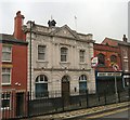
Stockport Savings Bank
A grade II listed building https://historicengland.org.uk/listing/the-list/list-entry/1393376 on Lower Hillgate. Premises of Stockport Savings Bank, built in 1912-13 to replace the savings bank in the same location, which was demolished in 1911. The earlier bank had originated in 1824 in Turner's Buildings, Little Underbank, later moving to the Lower Hillgate location. The bank, which opened in 1913, and later became a branch of Lloyds TSB, closed in the 1980s. The architect was Peter Pierce. The building is constructed in Portland limestone, brick, granite, Welsh slate roof, stone stacks. Image
Image: © Gerald England Taken: 8 Nov 2011
0.02 miles
3
Savings Bank frieze
Frieze on former Savings Bank Image
Image: © Gerald England Taken: 8 Nov 2011
0.02 miles
4
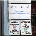
A psychic supper that needs advertising?
A notice in a window advertises a Psychic Supper at Pepper Mill Bistro, Saturday 7th September 2013.
Image: © Robin Stott Taken: 17 Aug 2013
0.02 miles
5
Robinson's Brewery, Stockport
Located in Lower Hillgate. The company's website contains further information - http://www.frederic-robinson.com/ .
Image: © Andrew Smith Taken: 20 Jul 2008
0.02 miles
6
Unicorn Brewery
F Robinson's (Unicorn) Brewert on Lower Hillgate.
Image: © David Dixon Taken: 20 Jul 2010
0.02 miles
7
Fredric Robinson (Unicorn) Brewery
On Lower Hillgate.
Image: © David Dixon Taken: 20 Jul 2010
0.02 miles
8
Robinson's Brewery
The entrance to Frederic Robinson's Unicorn Brewery on Lower Hillgate.
Image: © David Dixon Taken: 20 Jul 2010
0.02 miles
9
Bench mark on former Liberal Reform Club, Stockport
This Ordnance Survey bench mark is on the south east corner of the former Liberal Reform Club at the junction of Wellington Street with Lower Hillgate. The club was built in 1889 and is #10 on the Stockport Heritage Trail. More recently it was a nightclub, and then was converted into apartments in 2014. See also Image
Image: © John S Turner Taken: 5 Apr 2018
0.02 miles
10
Wellington Street/Lower Hillgate junction, Stockport
Looking north across the junction of Wellington Street with Lower Hillgate with the tower of St Mary's church in the distance. The building on the left is the former Liberal Reform Club and is #10 on the Stockport Heritage Trail, and there is an Ordnance Survey bench mark on the corner of the building - Image
Image: © John S Turner Taken: 5 Apr 2018
0.03 miles
  • ...