1
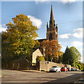
Daintry Terrace, Macclesfield
A short terrace of former silk-weavers' cottages.
Image: © Robin Stott
Taken: 4 Dec 2009
0.02 miles
2
Hope Street, Macclesfield
Seen over the wall of Fountain Mews. This is an area of former silk mill-workers' 2-up 2-down houses. The 3-storey house, right, suggests a weaver's house, with its wide second floor window to give plenty of light for weaving by. The view is towards the Buxton Road, A537.
Image: © Robin Stott
Taken: 4 Dec 2009
0.05 miles
3
Two new houses, Canal Street, Macclesfield
Image: © Alex McGregor
Taken: 4 Apr 2012
0.05 miles
4
Flint Street, Macclesfield
Looking towards Buxton Road A537 from Fountain Street.
Image: © Robin Stott
Taken: 27 Apr 2011
0.06 miles
5
Fountain Street, Macclesfield
A street near Buxton Road, east of the town centre. In the distance is the tower of St Michael and All Angels Church.
Image: © David Weston
Taken: 24 Mar 2021
0.06 miles
6
Hallefield Crescent, Macclesfield
Hovis Mill flats in the background.
Image: © Robin Stott
Taken: 27 Apr 2011
0.07 miles
7
The east end of St Paul's church, Macclesfield
A view of the east end of St Paul's church from the lower level of Daintry Street.
Image: © John S Turner
Taken: 20 Jun 2013
0.07 miles
8
The Wharf
The Wharf public house at the corner of Brook Street and Goodall Street in Macclesfield.
Image: © David Dixon
Taken: 3 Oct 2012
0.07 miles
9
Macclesfield
Image: © Peter McDermott
Taken: 11 Jul 2015
0.08 miles
10
St Paul's Parish Church
St Paul's Parish Church, Macclesfield, is a Grade II listed building. (http://list.english-heritage.org.uk/resultsingle.aspx?uid=1218224 National Heritage List for England). It was built in 1843–44, an example of a "Commissioners' Church" (http://en.wikipedia.org/wiki/Commissioners%27_church ), having received a grant towards its construction from the Church Building Commission.
Image: © David Dixon
Taken: 3 Oct 2012
0.08 miles


