
IMAGES TAKEN NEAR TO
Vicarage Road, BUNTINGFORD, SG9 9BH
Introduction
This page details the photographs taken nearby to Vicarage Road, SG9 9BH by members of the Geograph project.
The Geograph project started in 2005 with the aim of publishing, organising and preserving representative images for every square kilometre of Great Britain, Ireland and the Isle of Man.

There are currently over 7.5m images from over14,400 individuals and you can help contribute to the project by visiting https://www.geograph.org.uk
Image Map
Images are licensed for reuse under creativecommons.org/licenses/by-sa/2.0
Notes
- Clicking on the map will re-center to the selected point.
- The higher the marker number, the further away the image location is from the centre of the postcode.
Image Listing (32 Images Found)
Images are licensed for reuse under creativecommons.org/licenses/by-sa/2.0
Image
Details
Distance
1
High Street at the junction of Vicarage Road
Image: © David Howard
Taken: 28 Oct 2017
0.02 miles
2
Ermine Street at the junction of Freman Drive
Image: © David Howard
Taken: 28 Oct 2017
0.03 miles
3
Ermine Street, Buntingford
Ermine Street, entering the town of Buntingford in north Hertfordshire.
Image: © Malc McDonald
Taken: 25 Sep 2022
0.07 miles
5
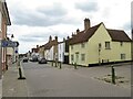
Buntingford High Street
The road in the foreground, as far as the side turning on the right, is Ermine Street. Beyond the junction it is Buntingford's High Street, although it lies on the route of the Ermine Street Roman road.
The High Street used to be on the route of the A10 trunk road, until Buntingford's by-pass was built, enabling trunk road traffic to avoid the town.
Image: © Malc McDonald
Taken: 25 Sep 2022
0.09 miles
6
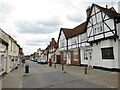
Buntingford High Street
The high street in Buntingford, a market town in north Hertfordshire. This road lies on the route of Ermine Street, a Roman road. It formed part of the route of the A10 trunk road, until a by-pass was built to divert through traffic away from the town centre.
Image: © Malc McDonald
Taken: 25 Sep 2022
0.13 miles
7
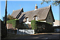
The Old Croft
A nice thatched cottage in Wyddial Road.
Image: © Melvyn Cousins
Taken: 9 Nov 2006
0.14 miles
8
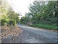
Vicarage Road, Buntingford
Crossing the River Rib
Image: © David Howard
Taken: 28 Oct 2017
0.15 miles
9
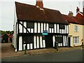
Tudor Cottage, Buntingford
A 16C timber-framed building, listed Grade II star/
Image: © Humphrey Bolton
Taken: 29 Jun 2024
0.15 miles
10
Bridge over the River Rib, Buntingford
Image: © David Howard
Taken: 28 Oct 2017
0.16 miles