IMAGES TAKEN NEAR TO
Mill End, BUNTINGFORD, SG9 0RP
Introduction
This page details the photographs taken nearby to Mill End, SG9 0RP by members of the Geograph project.
The Geograph project started in 2005 with the aim of publishing, organising and preserving representative images for every square kilometre of Great Britain, Ireland and the Isle of Man.

There are currently over 7.5m images from over14,400 individuals and you can help contribute to the project by visiting https://www.geograph.org.uk
Image Map
Images are licensed for reuse under creativecommons.org/licenses/by-sa/2.0
Notes
- Clicking on the map will re-center to the selected point.
- The higher the marker number, the further away the image location is from the centre of the postcode.
Image Listing (5 Images Found)
Images are licensed for reuse under creativecommons.org/licenses/by-sa/2.0
Image
Details
Distance
1
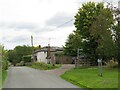
Mill End, near Buntingford
Mill End is a small hamlet in the north Hertfordshire countryside.
Image: © Malc McDonald
Taken: 25 Sep 2022
0.12 miles
2
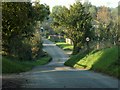
The hamlet of Mill End, Herts.
This shows the start of Mill End, travelling north.
Image: © Robert Edwards
Taken: 16 Oct 2006
0.12 miles
3
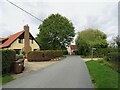
Mill End, near Buntingford
Mill End is a small hamlet in the north Hertfordshire countryside.
Image: © Malc McDonald
Taken: 25 Sep 2022
0.23 miles
4
Mill End, near Buntingford
Mill End is a small hamlet in the north Hertfordshire countryside.
Image: © Malc McDonald
Taken: 25 Sep 2022
0.24 miles
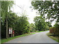
5
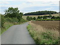
Lane near Buntingford
An un-named minor lane through countryside in north Hertfordshire.
Image: © Malc McDonald
Taken: 25 Sep 2022
0.24 miles