IMAGES TAKEN NEAR TO
Sandon, BUNTINGFORD, SG9 0QL
Introduction
This page details the photographs taken nearby to SG9 0QL by members of the Geograph project.
The Geograph project started in 2005 with the aim of publishing, organising and preserving representative images for every square kilometre of Great Britain, Ireland and the Isle of Man.

There are currently over 7.5m images from over14,400 individuals and you can help contribute to the project by visiting https://www.geograph.org.uk
Image Map
Images are licensed for reuse under creativecommons.org/licenses/by-sa/2.0
Notes
- Clicking on the map will re-center to the selected point.
- The higher the marker number, the further away the image location is from the centre of the postcode.
Image Listing (15 Images Found)
Images are licensed for reuse under creativecommons.org/licenses/by-sa/2.0
Image
Details
Distance
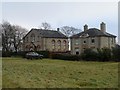
1
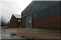
Sales of Sandon
They manufacture pet food. http://www.salesofsandon.co.uk/
Image: © David Howard
Taken: 10 Apr 2021
0.03 miles
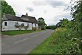
2
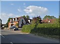
The Old Manse, Roe Green
The Old Manse is the one on the left.
Image: © Bikeboy
Taken: 23 Dec 2017
0.13 miles
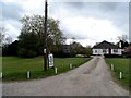
3
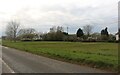
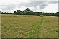
Cottages on Rushden Road by the footpath
Image: © Philip Jeffrey
Taken: 9 Jul 2023
0.14 miles
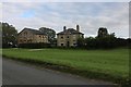
7
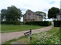
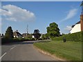
The Old Manse, Roe Green
The other house to the right has very similar brickwork and was obviously built at the same time.
Image: © Bikeboy
Taken: 17 May 2015
0.20 miles