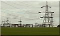
IMAGES TAKEN NEAR TO
Crabs Lane, BUNTINGFORD, SG9 0JB
Introduction
This page details the photographs taken nearby to Crabs Lane, SG9 0JB by members of the Geograph project.
The Geograph project started in 2005 with the aim of publishing, organising and preserving representative images for every square kilometre of Great Britain, Ireland and the Isle of Man.

There are currently over 7.5m images from over14,400 individuals and you can help contribute to the project by visiting https://www.geograph.org.uk
Image Map
Images are licensed for reuse under creativecommons.org/licenses/by-sa/2.0
Notes
- Clicking on the map will re-center to the selected point.
- The higher the marker number, the further away the image location is from the centre of the postcode.
Image Listing (8 Images Found)
Images are licensed for reuse under creativecommons.org/licenses/by-sa/2.0
Image
Details
Distance
1
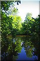
A Pelham Pond
This pond is in Pelham Nature Reserve, an education centre managed by the Essex Wildlife Trust http://www.essexwt.org.uk/.
National Grid who own the site have set up a nature reserve that is used by hundreds of school children and a few adults each year. Vehicular access to the reserve is by appointment only. However there is a public footpath through the reserve, a visit will involve a walk of about 1km. For more info see http://www.earthcentrenetwork.org.uk/members/UKECN/member054.html
Image: © Glyn Baker
Taken: 25 Jul 2009
0.08 miles
2
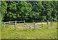
Pelham Henge?
This modern henge is on Pelham Nature Reserve, an Essex County Council education centre managed in association the Essex Wildlife Trust http://www.essexwt.org.uk/.
National Grid who own the site have set up a nature reserve that is used by hundreds of school children and a few adults each year. Vehicular access to the reserve is by appointment only. However there is a public footpath through the reserve, a visit will involve a walk of about 1km. For more info see http://www.earthcentrenetwork.org.uk/members/UKECN/member054.html
Image: © Glyn Baker
Taken: 25 Jul 2009
0.09 miles
3
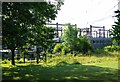
Pelham Nature Reserve
The left hand side of the building is an education centre run jointly by Essex & Hertfordshire Councils and the Essex Wildlife Trust http://www.essexwt.org.uk/. See some more pictures at http://www.geograph.org.uk/search.php?i=34353987 .
National Grid who own the site have set up a nature reserve that is used by hundreds of school children and a few adults each year. Vehicular access to the reserve is by appointment only. However there is a public footpath through the reserve, a visit will involve a walk of about 1km. For more information see https://www.ukschooltrips.co.uk/directory/pelham-centre-for-the-environment-essex.html Continue on a virtual tour of Wildlife Trust Reserves in Essex by visiting
Image
Image: © Glyn Baker
Taken: 25 Jul 2009
0.09 miles
4
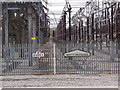
County Boundary with fizz
Electricity sub station at Crabbs Green.
Ticks the Boundary and Barrier box nicely.
Image: © Michael Trolove
Taken: 12 May 2013
0.18 miles
5
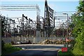
Pelham Substation
This photograph was taken from the approach road to the station, which is a public footpath, as is the road that forms the top of the “T” of this junction.
Image: © Glyn Baker
Taken: 25 Jul 2009
0.22 miles
7
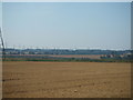
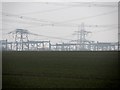
View towards Stocking Pelham
Stocking Pelham grid station can just be seen on the horizon in the centre of the photograph.
Image: © David Beresford
Taken: 5 Sep 2013
0.24 miles