
IMAGES TAKEN NEAR TO
Anstey, BUNTINGFORD, SG9 0DJ
Introduction
This page details the photographs taken nearby to SG9 0DJ by members of the Geograph project.
The Geograph project started in 2005 with the aim of publishing, organising and preserving representative images for every square kilometre of Great Britain, Ireland and the Isle of Man.

There are currently over 7.5m images from over14,400 individuals and you can help contribute to the project by visiting https://www.geograph.org.uk
Image Map
Images are licensed for reuse under creativecommons.org/licenses/by-sa/2.0
Notes
- Clicking on the map will re-center to the selected point.
- The higher the marker number, the further away the image location is from the centre of the postcode.
Image Listing (81 Images Found)
Images are licensed for reuse under creativecommons.org/licenses/by-sa/2.0
Image
Details
Distance
1
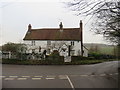
Snow End House, Anstey
Snow End House in the village of Anstey, in north Hertfordshire.
Image: © Malc McDonald
Taken: 25 Jan 2020
0.01 miles
3

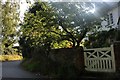
Lane in Anstey
A lane in the village of Anstey, in north Hertfordshire.
The signpost to the left of the image is unusual in having one modern arm and two arms which are older. The modern arm is likely to have been added to repair the sign following damage.
Image: © Malc McDonald
Taken: 25 Jan 2020
0.02 miles
4
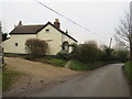
Houses in Anstey
Houses in the village of Anstey, in north Hertfordshire.
Image: © Malc McDonald
Taken: 25 Jan 2020
0.08 miles
5
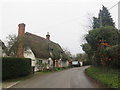
Thatched cottage in Anstey
A thatched cottage in the north Hertfordshire village of Anstey.
Image: © Malc McDonald
Taken: 25 Jan 2020
0.09 miles
9
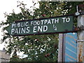
A relief, no doubt!
I couldn't resist taking a photograph of this public footpath sign outside the church in Anstey.
Image: © Mark Hurn
Taken: 28 Aug 2010
0.20 miles
10
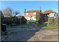
Anstey: Hillside and St George's lychgate
The house is much older than it appears: "C16, late C16 inserted floor and E end chimney, heightened to two storeys after fire in mid C20. Timber frame roughcast with red tilehung first floor and red pantiled roof" (Grade II listing). The lychgate is also Grade II listed. It dates from the 15th century or earlier and was altered in 1831 to include a lock-up with flint and brick walls.
Image: © John Sutton
Taken: 17 Jan 2023
0.21 miles