IMAGES TAKEN NEAR TO
Upper Coombe Farm, ROYSTON, SG8 9SA
Introduction
This page details the photographs taken nearby to Upper Coombe Farm, SG8 9SA by members of the Geograph project.
The Geograph project started in 2005 with the aim of publishing, organising and preserving representative images for every square kilometre of Great Britain, Ireland and the Isle of Man.

There are currently over 7.5m images from over14,400 individuals and you can help contribute to the project by visiting https://www.geograph.org.uk
Image Map
Images are licensed for reuse under creativecommons.org/licenses/by-sa/2.0
Notes
- Clicking on the map will re-center to the selected point.
- The higher the marker number, the further away the image location is from the centre of the postcode.
Image Listing (9 Images Found)
Images are licensed for reuse under creativecommons.org/licenses/by-sa/2.0
Image
Details
Distance
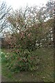
1
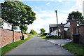
Coombe Farm, Coombe Road near Kelshall
Only half of this farm is in this square, from the car upwards it is in the next one.
Image: © Mick Malpass
Taken: 28 Aug 2012
0.02 miles
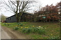
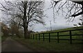
6
Horseshoe Wood by Coombe Road, Thrift Hill
Image: © David Howard
Taken: 10 Apr 2021
0.20 miles
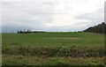
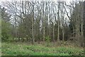
7
Thrift Hill
Numerous rabbits, a horse and rider and a buzzard are all in this picture.
Image: © Jeff Tomlinson
Taken: 16 Apr 2007
0.21 miles
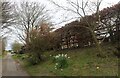
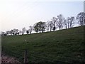
8
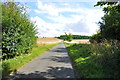
Coombe Road looking towards Horseshoe Wood and Kelshall
Coombe Road ends on the skyline and meets the road to Therfield and Kelshall.
Image: © Mick Malpass
Taken: 28 Aug 2012
0.22 miles