
IMAGES TAKEN NEAR TO
Lankester Road, ROYSTON, SG8 9DG
Introduction
This page details the photographs taken nearby to Lankester Road, SG8 9DG by members of the Geograph project.
The Geograph project started in 2005 with the aim of publishing, organising and preserving representative images for every square kilometre of Great Britain, Ireland and the Isle of Man.

There are currently over 7.5m images from over14,400 individuals and you can help contribute to the project by visiting https://www.geograph.org.uk
Image Map
Images are licensed for reuse under creativecommons.org/licenses/by-sa/2.0
Notes
- Clicking on the map will re-center to the selected point.
- The higher the marker number, the further away the image location is from the centre of the postcode.
Image Listing (31 Images Found)
Images are licensed for reuse under creativecommons.org/licenses/by-sa/2.0
Image
Details
Distance
4
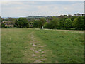
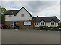
Path to Royston
Footpath off Therfield Heath.
Image: © Hugh Venables
Taken: 29 Apr 2017
0.12 miles
7
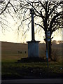
Queen Vic
Memorial erected in 1901 to Queen Victoria. Then renewed in Queen Elizabeth II's Silver Jubilee year.
Image: © Dennis simpson
Taken: 18 Jan 2011
0.16 miles
8
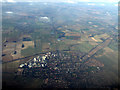
Royston from the air
Viewed from a Luton bound flight from Prague.
Image: © Thomas Nugent
Taken: 27 Feb 2013
0.17 miles
9
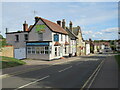
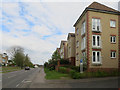
Baldock Street, Royston
Baldock Street heading into the centre of Royston in north Hertfordshire.
Image: © Malc McDonald
Taken: 25 Sep 2022
0.18 miles
10
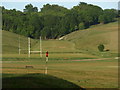
Sporting Activities
Part of the golf course, a rugby pitch and what I think is the remains of a rifle range, visible on the map. the range was in existence from 1890s till the 1980s. All on Therfield Heath.
Image: © Dennis simpson
Taken: 24 May 2011
0.19 miles