IMAGES TAKEN NEAR TO
Briary Lane, ROYSTON, SG8 9BX
Introduction
This page details the photographs taken nearby to Briary Lane, SG8 9BX by members of the Geograph project.
The Geograph project started in 2005 with the aim of publishing, organising and preserving representative images for every square kilometre of Great Britain, Ireland and the Isle of Man.

There are currently over 7.5m images from over14,400 individuals and you can help contribute to the project by visiting https://www.geograph.org.uk
Image Map
Images are licensed for reuse under creativecommons.org/licenses/by-sa/2.0
Notes
- Clicking on the map will re-center to the selected point.
- The higher the marker number, the further away the image location is from the centre of the postcode.
Image Listing (103 Images Found)
Images are licensed for reuse under creativecommons.org/licenses/by-sa/2.0
Image
Details
Distance
2
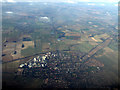
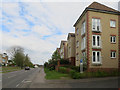
Royston from the air
Viewed from a Luton bound flight from Prague.
Image: © Thomas Nugent
Taken: 27 Feb 2013
0.09 miles
5
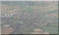
Royston from the air
This view over the town of Royston vividly shows the straightness of the Roman road, Ermine Street, which now forms the A1198 towards Papworth and Huntingdon. Southwards, Ermine Street disappears from the picture as the A10 towards London. (The A10 continues northeast to Cambridge, leaving the picture, along with the railway line, about ¼ down the right-hand edge.)
Image: © Chris Downer
Taken: 12 Nov 2007
0.13 miles
6
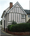
Timber-frame building in Upper King Street
This building has decorative plasterwork or pargetting on the front.
Image: © Jo Edkins
Taken: 24 Sep 2008
0.14 miles
7
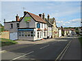
Baldock Street, Royston
Baldock Street heading into the centre of Royston in north Hertfordshire.
Image: © Malc McDonald
Taken: 25 Sep 2022
0.14 miles
8
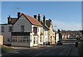
Royston: Baldock Street
Looking towards the town centre on a bright February morning. The three-storey yellow-brick house has a prominent date stone marking Queen Victoria's Diamond Jubilee in 1897.
Image: © John Sutton
Taken: 2 Feb 2016
0.14 miles
9
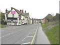
Baldock Street, Royston
The building on the left is named as The Jockey Pub and Thai Restaurant; it was formerly called The Jockey Inn. It stands almost opposite to Briary Lane, marked as where the single yellow line ends.
Image: © John Baker
Taken: 31 Mar 2012
0.14 miles