IMAGES TAKEN NEAR TO
Lower Gower Road, ROYSTON, SG8 5EA
Introduction
This page details the photographs taken nearby to Lower Gower Road, SG8 5EA by members of the Geograph project.
The Geograph project started in 2005 with the aim of publishing, organising and preserving representative images for every square kilometre of Great Britain, Ireland and the Isle of Man.

There are currently over 7.5m images from over14,400 individuals and you can help contribute to the project by visiting https://www.geograph.org.uk
Image Map
Images are licensed for reuse under creativecommons.org/licenses/by-sa/2.0
Notes
- Clicking on the map will re-center to the selected point.
- The higher the marker number, the further away the image location is from the centre of the postcode.
Image Listing (45 Images Found)
Images are licensed for reuse under creativecommons.org/licenses/by-sa/2.0
Image
Details
Distance
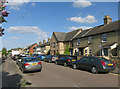
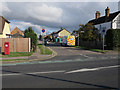
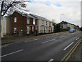
3
Houses by the roundabout on the Old North Road
Image: © Philip Jeffrey
Taken: 19 Aug 2023
0.14 miles
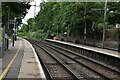
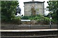
6
The North Star and Old North Road
The view from the railway bridge.
Image: © Mike W Hallett
Taken: 16 Aug 2009
0.18 miles
7
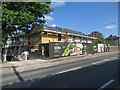
Converting the North Star
Image: © Hugh Venables
Taken: 16 May 2015
0.18 miles
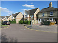
8
New houses by Old North Road
Image: © Hugh Venables
Taken: 23 Oct 2016
0.18 miles
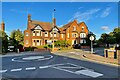
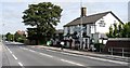
9
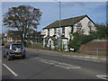
The North Star, Royston
A former pub, now sold to be converted into flats. See Image
Image: © Hugh Venables
Taken: 5 Oct 2014
0.19 miles