IMAGES TAKEN NEAR TO
The Green, ROYSTON, SG8 0NA
Introduction
This page details the photographs taken nearby to The Green, SG8 0NA by members of the Geograph project.
The Geograph project started in 2005 with the aim of publishing, organising and preserving representative images for every square kilometre of Great Britain, Ireland and the Isle of Man.

There are currently over 7.5m images from over14,400 individuals and you can help contribute to the project by visiting https://www.geograph.org.uk
Image Map
Images are licensed for reuse under creativecommons.org/licenses/by-sa/2.0
Notes
- Clicking on the map will re-center to the selected point.
- The higher the marker number, the further away the image location is from the centre of the postcode.
Image Listing (6 Images Found)
Images are licensed for reuse under creativecommons.org/licenses/by-sa/2.0
Image
Details
Distance
3
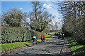
Steeple Morden: cyclists and tractor
Cyclists making for Litlington on the sunny morning of Good Friday.
Image: © John Sutton
Taken: 25 Mar 2016
0.15 miles
4
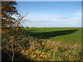
Farmland at Morden Green
Probably part of Greenway Farm.
Image: © David Purchase
Taken: 8 Dec 2013
0.15 miles
5
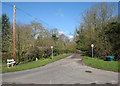
Steeple Morden: Brook End
Cheyney Street to the left, Litlington Road to the right, Hillside Farm ahead.
Image: © John Sutton
Taken: 25 Mar 2016
0.17 miles
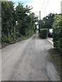
6
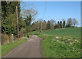
Steeple Morden: a jogger on Brook End
Near Hillside Farm (hidden by trees) on the sunny morning of Good Friday.
Image: © John Sutton
Taken: 25 Mar 2016
0.24 miles