IMAGES TAKEN NEAR TO
Green Lane, BALDOCK, SG7 5LW
Introduction
This page details the photographs taken nearby to Green Lane, SG7 5LW by members of the Geograph project.
The Geograph project started in 2005 with the aim of publishing, organising and preserving representative images for every square kilometre of Great Britain, Ireland and the Isle of Man.

There are currently over 7.5m images from over14,400 individuals and you can help contribute to the project by visiting https://www.geograph.org.uk
Image Map
Images are licensed for reuse under creativecommons.org/licenses/by-sa/2.0
Notes
- Clicking on the map will re-center to the selected point.
- The higher the marker number, the further away the image location is from the centre of the postcode.
Image Listing (78 Images Found)
Images are licensed for reuse under creativecommons.org/licenses/by-sa/2.0
Image
Details
Distance
1
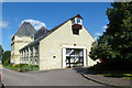
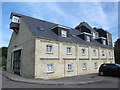
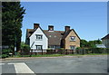
The Maltings, Ashwell
A residential conversion of what were, presumably, maltings.
Image: © Robin Webster
Taken: 6 Sep 2015
0.01 miles
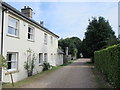

9
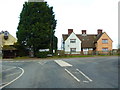
Junction of Lucas Lane and Station Road, Ashwell
Image: © Alexander P Kapp
Taken: 4 Feb 2013
0.04 miles
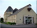
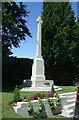
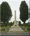
10
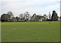
Ashwell Recreation Ground
A view across the roped-off square towards The Maltings and the village war memorial.
Image: © John Sutton
Taken: 1 Apr 2016
0.04 miles