IMAGES TAKEN NEAR TO
Cavendish Lane, SG5 4SL
Introduction
This page details the photographs taken nearby to Cavendish Lane, SG5 4SL by members of the Geograph project.
The Geograph project started in 2005 with the aim of publishing, organising and preserving representative images for every square kilometre of Great Britain, Ireland and the Isle of Man.

There are currently over 7.5m images from over14,400 individuals and you can help contribute to the project by visiting https://www.geograph.org.uk
Image Map (Loading...)


Getting Data...Please wait
Leaflet Map data © OpenStreetMap
Images are licensed for reuse under creativecommons.org/licenses/by-sa/2.0
Notes
- Clicking on the map will re-center to the selected point.
- The higher the marker number, the further away the image location is from the centre of the postcode.
Image Listing (28 Images Found)
Images are licensed for reuse under creativecommons.org/licenses/by-sa/2.0
Image
Details
Distance
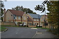
1
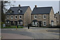
New houses overlooking roundabout on Hitchin Road
Image: © David Martin
Taken: 13 Nov 2022
0.05 miles
4
Pond on the edge of Fairfield
Looks like it's been a while since there was deep water in here. Just a dribble in the bottom today even after the heavy rain.
Image: © Philip Jeffrey
Taken: 30 Oct 2022
0.10 miles
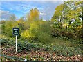
6
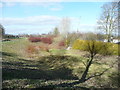
Rainfall storage basin, Fairfield Hall
This depression in the ground has an outlet pipe, so I feel sure it was made to store rainfall runoff and reduce the flow to Pix Brook. However I could not see any inlet pipes.
Image: © Humphrey Bolton
Taken: 20 Mar 2018
0.11 miles
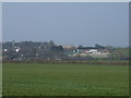
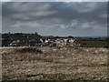
7
Pig Industry Development Authority buildings, Stotfold
These buildings are now derelict, but around the 1960 - 1970 period, this was a testing facility for checking the growth of pigs from weaning to slaughter. I have some very good memories of this place, it is so sad to see it now.
Update. July 24 2015, Biggleswade Chronicle reports.
Plans for a new care home, a new lower school and 116 new homes were approved by Central Beds Council for this site.
Image: © Mick Malpass
Taken: 28 Aug 2012
0.11 miles
8
Building work at what was The Pig Development Unit
Image: © Jeff Tomlinson
Taken: 18 Feb 2018
0.13 miles
9
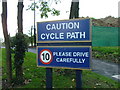
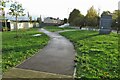
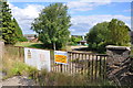
Cycle path
Now pay attention. This sign is at the gates of an old psychiatric hospital. Cyclepath - think about it.
Image: © Robin Hall
Taken: 30 Oct 2005
0.14 miles
10
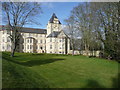
The eastern end of Fairfield Hall
See also Image
Image: © Humphrey Bolton
Taken: 20 Mar 2018
0.14 miles